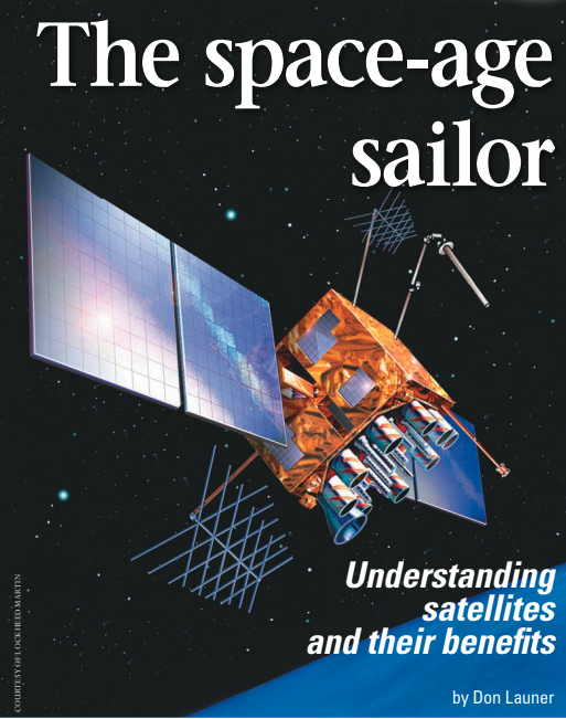
Understanding satellites and their benefits
Issue 55 : Jul/Aug 2007
Today about 2,700 man-made satellites circle the Earth, but our satellite age had very humble beginnings. In October 1957, 12 years after the end of World War II, Sputnik, the first man-made satellite, was thrust into orbit around the Earth by the U.S.S.R. In an effort to learn as much about Sputnik as possible, the U.S. monitored the beeping signal it transmitted and was able to track it through the Doppler effect. This was the genesis of using man-made satellites to determine navigational information. But it wasn’t until the 1970s when satellite-based navigation, as we now know it, began to take shape. And in recent years satellite technology has created a number of services for today’s sailors: entertainment, communication, weather, search and rescue, and navigational information.
Shooting for the stars
Because of limited booster-rocket technology, the early satellites had to have a low-weight payload and a low orbit. In fact, the early satellites were just on the outer edge of the Earth’s atmosphere, in what we call a Low Earth Orbit (LEO). For all satellites, both man-made and natural, their height above the Earth determines their orbital (angular) speed. The early LEO satellites had Earth orbits of two hours or less. The elliptical path of Sputnik, with a maximum altitude of about 560 miles, caused the 183-pound device to circle the Earth every 96 minutes. By contrast, we have a satellite that’s over a quarter-million miles away from the Earth and takes 28 days to complete an orbit: our moon.
As booster rockets increased in size, larger satellites could be launched into higher orbits. Finally, a satellite was put into an orbit 22,236 statute miles above mean sea level at the equator, in an orbit rotating in the same direction as the Earth. This height was a magical number. In 1945, when manmade satellites were still considered a fantasy, science-fiction writer Arthur C. Clarke proposed that if a satellite could be put into orbit above the equator at this altitude, its angular orbital speed would be the same as that of the Earth and it would appear to be mo-tionless in the sky.
In the 1960s, satellites could finally be placed in orbits that high. This type of satellite is called geostationary. The terminology of satellite orbits is complex, but suffice to say that a close cousin of the geostationary orbit is the geosynchronous. Such an orbit is canted to the equator and/or elliptical, and while the satellite appears more or less stationary (if you could see it), it actually “moves” slightly in the sky. Whether geostationary or geosynchronous in their orbits, such satellites are ideal for providing constant communications with the surface over which they are positioned.
A satellite’s footprint
Early satellites employed omni-directional antennas, which sent most of the satellite’s transmitted energy into outer space. It wasn’t long before the limited powers of the satellites’ transmitters were concentrated onto a relatively small portion of the Earth’s surface, directed at specific subscribers. The pattern of this concentrated beam was termed the satellite’s footprint. As the distance from the center of this footprint increases, the received signal drops off to lower limits of intensity. A satellite whose audience is in the continental U.S. will have a footprint covering just that area and not extending very far beyond.
Footprint maps are available for individual satellites. Contour lines show where the intensity of the signal decreases from beam-center values. Each contour line has a defined signal strength expressed in dBW, referenced to 1 watt of power. These footprints may be global, reaching over 42.4 percent of the Earth’s surface (such as that of an individual GPS satellite), or they may be hemispheric, country, or spot footprints.
Satellites for sailors
Navigation – When most sailors think about boating-related satellites, the NAVSTAR Global Positioning System (GPS) comes to mind. It is a satellite navigation system that began with experimental satellites in 1978 and was fully operational by 1995. It was designed for and is operated by the U.S. Air Force, but its signals are freely available and used by millions of civilians worldwide. The basic space segment of this system, known as the GPS Operational Constellation, consists of at least 24 satellites (see illustration on Page 39). There are often more than 24 in space, as new ones are placed in orbit to replace those whose fuel is nearly exhausted.
The GPS constellation has six satellite orbits, with four or more satellites traveling in each orbital plane. These orbits are spaced around the equator 60 degrees apart with the orbital planes canted about 55 degrees to the equatorial plane. With the orbits about 12,000 miles above the Earth, each satellite orbits the Earth about twice a day. This GPS constellation configuration provides the user at any point on Earth with five or more visible satellites at any time. With access to just three satellites, a two-dimensional fix (latitude and longitude) can be determined. With four satellites, GPS receivers can compute a location in three dimensions. This makes the system ideal for aircraft, boats, ground transportation, and hikers.
Each GPS satellite contains an atomic clock and, by measuring the time interval between the transmission and reception of a satellite signal, a spherical line-of-position (LOP) is created around each satellite. The intersections of these spherical lines-of-position determine your location.
The GPS satellites transmit in the microwave spectrum. At these frequencies, the wavelength is very short and the receiving antenna can consequently be very small. One of the problems with these frequencies is that they do not easily pass through things like house roofs, cabintops, or people. If you’re holding a hand-held GPS at waist height, the receiver has difficulty acquiring a satellite from the other side of your body.
When initially put into service, the GPS system was so accurate, the Department of Defense deliberately introduced an error into the civilian GPS system to maintain an accuracy advantage over potential enemies. Selective Availability (SA) manipulated, or “dithered,” the atomic clock output of GPS satellites, degrading the accuracy of the position signals available to civilians up to 100 meters.
However, this deliberate error posed a potential hazard to users. If a boat were coming through a narrow inlet in a fog, the error margin could put it on the rocks. In North America, the Canadian and U.S. Coast Guards established low-frequency AM ground stations along the coast. Accessing the data from one of these Coast Guard stations would counter the SA error and improve position accuracy to about 10 meters. This augmentative service, Differential GPS (DGPS), requires a separate antenna system and receiver, which is frequently more expensive than the GPS receiver itself. Finally, in May 2000, the SA error was discontinued (officially, the SA value was set to zero); overnight, GPS users worldwide had a dramatically more accurate system.
There were still potential errors in the system, such as clock errors, ionospheric and tropospheric delays as the signal travels from the satellites to earth, earth reflections, satellite orbital drifts, and control errors. But DGPS ground stations could reduce most of these errors. Unfortunately, those ground stations not only required the separate receiver and antenna, but also had limited range and were subject to noise and fading. So geostationary satellites, operating in the same frequency band as the GPS satellites, were put in orbit. These new satellites provide corrections that can be received directly on a GPS antenna without the need of a separate receiver and antenna system. This improved correction system is known as the Wide Area Augmentation System (WAAS).
No matter how accurate the system may be, bear in mind that your charts may have been created in a day in which this level of accuracy was not available. The accuracy of GPS has challenged hydrographic services around the world to improve their cartography before releasing official digital versions that can be used in concert with GPS.
Satellite weather – Satellite weather is available on a subscription basis and can provide the sailor with weather maps that can be directly overlaid on multifunction displays (MFDs) or printouts. In addition to seeing weather in your vicinity and along your projected path, the service provides current conditions, surface analysis of the high- and low-pressure centers, marine forecasts and warnings, tropical storm tracks, lightning information, hurricane tracks, visibility forecasts, wind speeds, sea-level temperature, sea-surface conditions, wind direction, wave period, wave direction, wave height, and buoy data. XM WX and Sirius Marine Weather are currently the two most popular of these weather services. The Sirius satellite footprint covers the 48 continental states up to several hundred miles offshore into the Atlantic and Pacific, the Gulf of Mexico, and the Caribbean.
In February 2007, XM Satellite Radio Holdings Inc. and Sirius Satellite Radio Inc. agreed to merge. This merger faces regulatory hurdles in Washington with the Federal Communications Commission and will need anti-trust approval from the Department of Justice. At this writing, the merger was not yet consummated.
Search and rescue – The best known of all search-and-rescue services uses the Emergency Position Indicating Radio Beacon (EPIRB). Early EPIRBs operated on 121.5 MHz, a frequency designed for detection by aircraft before satellites were available. This frequency was not ideal for a satellite system, however, and the newer EPIRB system operating on 406.025 MHz is more compatible with satellites, provides global coverage, is more reliable, and includes better vessel data. On January 1, 2007, 121.5 MHz EPIRBs became illegal to operate on commercial and recreational watercraft in the U.S. On January 1, 2009, the search-and-rescue COSPAS-SARSAT satellite program will terminate its processing of distress signals on 121.5 MHz.
The EPIRB of a vessel in distress sends out an automatic Unique Identification Number (UIN) to the COSPAS-SARSAT satellite search-and-rescue (SAR) system, which was established by the U.S., Canada, France, and Russia, and employs American NOAA (SARSAT) and Russian (COSPAS) satellites. The UIN, which has previously been registered with the relevant national authority (it’s the Coast Guard for American vessels, the National Search and Rescue Secretariat for Canadian ones), identifies the vessel in trouble. This information, along with the vessel’s location, is then received at a Local User Terminal (LUT), which is a satellite ground station. The information goes to a Mission Control Center (MCC) and then to a Rescue Coordination Center (RCC), from which rescue operations are deployed. The position of a 406-MHz EPIRB is determined by using a LEO satellite employing Doppler shift, which takes time for an accurate fix to be acquired.
The weakness of the EPIRB system is the use of satellites that follow transpolar orbits. Because they are constantly orbiting, there can be a lag of hours from the time an EPIRB sends out a distress signal to the moment that a COSPAS-SARSAT satellite is in a position to receive it. The system is augmented by the use of geostationary weather satellites, which can promptly detect an EPIRB signal. Because they’re geostationary, they can’t use Doppler shift to pinpoint the location, but they are important in getting a search and rescue under way.
For instantaneous positioning of a distress signal, there is GPIRB, which is an EPIRB with an internal GPS that transmits an accurate fix without the Doppler-shift location delay.
In addition to the EPIRB, which is tied to a specific vessel, offshore sailors, hikers, and others can now wear individual locators, Personal Locator Beacons (PLBs). These devices are smaller and less expensive than an EPIRB and make use of the same search-and-rescue satellites as the EPIRBs.
Satellite telephone – A satellite telephone, or satphone, communicates directly with orbiting satellites. Some systems use satellites that are geostationary; others make use of LEO satellites with an orbital time of 70 to 90 minutes. Since the LEO satellites are much closer to the Earth, their signal strength is greater than that of the geostationary satellites, so a smaller antenna can be used. In addition, the LEO satellites can provide worldwide coverage with no gaps. As each LEO satellite passes overhead and sets below the horizon, the calls are handed over to the next satellite. As with many other services, this is a commercial venture that requires a subscription.
Globalstar markets a multipurpose hand-held phone that can be used as a cell phone or satellite phone. It can be used up to 200 to 300 miles off the coastal U.S. as well as the Bahamas, the Gulf of Mexico, and the eastern Caribbean. Iridium has a hand-held satellite phone that can be used for voice or data and has global coverage. Inmarsat provides three different services, with global coverage.
Satellite radio – Subscription radio, or satellite radio, is supplied by commercial businesses and requires a subscription from the end users. These companies offer a large selection of radio channels, including music, news, weather, and sports. The signal from the satellites is strong enough that a dish-type receiving antenna is not necessary. The transmitted signals, on the S band (2.3 GHz), are encoded and require a proprietary receiver for decoding and playback. Each of these receivers, or tuners, has an electronic serial number, and can be activated through an authorization code when the subscription is active. Portable receivers or tuners are available for $100 to $200. A monthly fee of about $12.95 is charged for service, with lower prices available for yearly contracts.
The audio reception quality is not always as good as terrestrial FM reception, since many radio channels are crowded into a tight satellite bandwidth. In the U.S., XM Satellite Radio and Sirius Satellite Radio are the two major companies supplying this service.
Satellite TV – Reception of TV from a satellite requires a dish antenna. For marine purposes, this dish must be fully stabilized in order to receive the required satellite signals, but with current technology these dishes can track a satellite even on a severely rolling, pitching boat. Fixed dishes can also be mounted on a dockside piling. In the early days of satellite TV, the onboard dishes, enclosed in a dome, were very large in size. But domes of less than 16 inches in diameter have become available recently, making satellite TV practical even on boats of less than 30 feet. These dish-domes cost several thousand dollars, but small, portable, non-tracking satellite dishes, at a price of less than $300, are also available for very stable boats or boats that are in slips with the dish located on the dock. Satellite TV’s footprint allows reception up to about 100 to 200 miles off the coast.
As with satellite radio, the service is available on a subscription basis, and typically provides more than 300 channels of commercial-free TV, as well as music channels.
What next?
We have been part of the satellite age for a half century now. During this time the technology and services have expanded exponentially, but it’s impossible to predict what services and conveniences will be available to future sailors. However, there’s no doubt they will be as astounding.
Thank you to Sailrite Enterprises, Inc., for providing free access to back issues of Good Old Boat through intellectual property rights. Sailrite.com