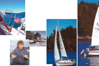
When cruising, our days begin with tea and the forecast
Issue 74 : Sept/Oct 2010
One of the biggest lessons I’ve learned as we cruise is the difference between weather reports for the landed gentry and weather reports for sailors. Our home doesn’t fl oat, doesn’t tug at its anchor, and isn’t in danger in high winds. When we go from our home to anyplace else, we generally drive a car that isn’t particularly affected by wind speed or direction. We can drive from point A to point B in the rain and never get wet, cold, or miserable.
As a result, we don’t study the weather much when we’re living at home. The term “weather permitting” doesn’t come up. The weather rates a passing glance when we notice something unusual or particularly lovely but we don’t race to an online weather service to see what’s causing the phenomenon. We don’t think about which direction the wind is blowing. We certainly don’t get up in the morning and check the day’s weather outlook with our first cup of tea. Not when we’re on land.
This summer, we’ve been living aboard, and that has given the weather new meaning. It’s the first thing we check each day. We know what systems are driving the current weather and we study the unseen weather systems out there to the west of us, since those highs and lows will soon affect us. We have a very personal interest in how hard the wind will blow and from what direction. We care — suddenly a great deal — about any precipitation it might bring. Our boat’s boom is too low for a dodger or other protective canvas. For those aboard Mystic, rain means wearing our own protection in the form of extra-warm foul weather gear. When the wind blows across Lake Superior’s cold water, it makes everything colder. The worst is when it’s wet and cold at the same time. We try to avoid getting caught in that combination.
We have an endless horizon out here on the big lake, which allows us to make a visual study of the weather. But we also have one more magic trick that has made it easier to predict what we’re about to experience: WxWorx on Water. This is a satellite feed that makes it possible to see the highs and lows across North America and the radar view of clouds in the U.S. (We wish more of Canada were covered, since much of our cruising is in Canada, but we’re able to interpolate from the data we do receive.) With WxWorx, we see wave heights and direction, the locations of all severe storm warnings, weather buoy reports, and the text of NOAA’s marine forecast. We don’t have to be near civilization and a television to receive this information. We get it as often as we like and no matter how far we travel.
Our three-month cruise will come to an end as you read this issue. In mid-September, we’ll return to where we began in late June . . . weather permitting.
Thank you to Sailrite Enterprises, Inc., for providing free access to back issues of Good Old Boat through intellectual property rights. Sailrite.com