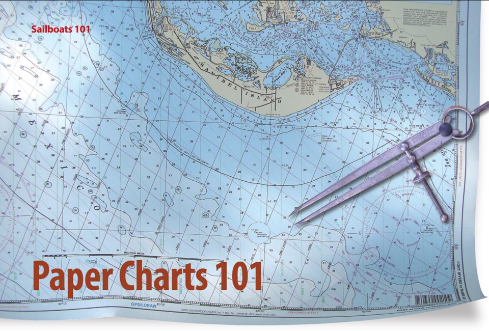
Some sailors still value the printed world
Issue 98: Sept/Oct 2014
In 1807, President Thomas Jefferson recognized the necessity for accurate coastal navigation charts. Since 1862, the U.S. government has printed lithographed nautical charts that have been sold to the public through commercial vendors. After 153 years, all that changed on April 13, 2014, when the federal government decided to get out of the chart-printing business and discontinued its printing of lithographic paper charts. This decision was based on the declining use of paper charts, the increased use of electronic charts, and federal budget restrictions.
Nearly all of NOAA’s more than 1,000 different charts have already been available on a print-on-demand basis from NOAA-certified agents, and they are still. These charts are up-to-date as of the time of printing. As an aside, although recreation vessels are not required to have paper charts on board, the USCG requires all commercial vessels operated by licensed officers to carry paper charts.
Even though it seems that pixels are replacing paper, many old-timers who grew up with paper charts still use them as our format of choice.
Advantages of paper charts
The obvious advantage of paper charts is that they do not depend on a source of electricity. A few years ago we were in the Atlantic off the eastern tip of Long Island. Unknown to us, our alternator had failed the day before. This became clear when our battery voltage dropped to a point where it could no longer sustain our electronic navigation gear. But this was not a problem, since our paper chart book of the area helped us reach a marina on the North Fork where the alternator could be repaired.
If you looked at our paper charts, you’d see hand-written notes on them from past cruises, indicating good storm refuges, notes on inlets, waterfront restaurants, and similar handy information (along with some rings from margarita glasses). Although most electronic charts can also be updated with notes, it is usually only to a limited extent.
On a cruise to a new area, in the evenings I enjoy spreading out the paper chart on the table and marking the routes, waypoints, and compass headings for the following day’s proposed voyage. Even though we will probably be using our GPS for navigation, it only takes an electrical failure — such as a dead battery due to a failed alternator or one nearby lightning strike — to put us back to navigating by compass and paper charts as was done before the electronic age.
Disadvantages of paper charts
For paper charts to remain accurate, they have to be updated by hand from the changes published in the Coast Guard’s Local Notice to Mariners. Because it’s a laborious process, it’s the rare sailor who tackles this chore. Electronic charts, on the other hand, have the advantage that changes can be downloaded with chart updates, although I suspect that these updates are infrequently downloaded by the average sailor. Paper charts are more difficult to use in windy or rainy conditions, and sailors using paper charts in cockpits that are open to the weather should investigate the options of water-resistant or laminated print-on-demand charts.
Storing paper charts
Although paper-chart purists condemn folding charts, storing them flat and unfolded on a small boat can be a challenge that usually requires a specialized construction job. Of course, you can fold your charts (when nobody’s looking) and it’s much easier to find or create storage space for folded charts and spiral-bound chart books.
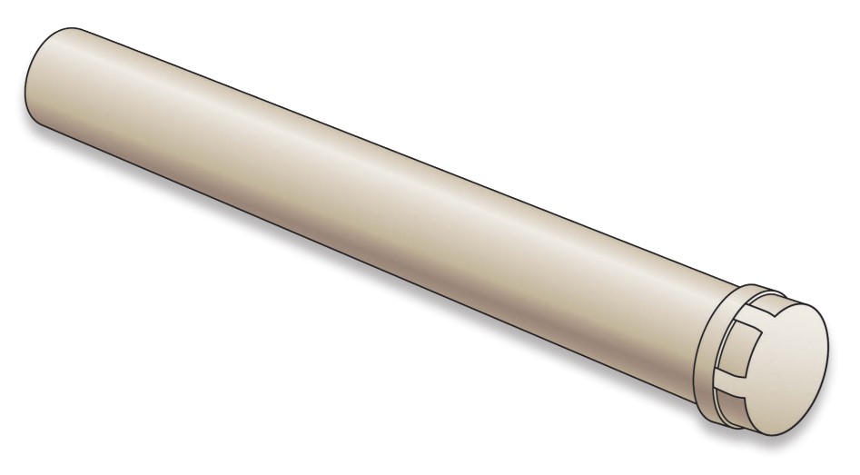
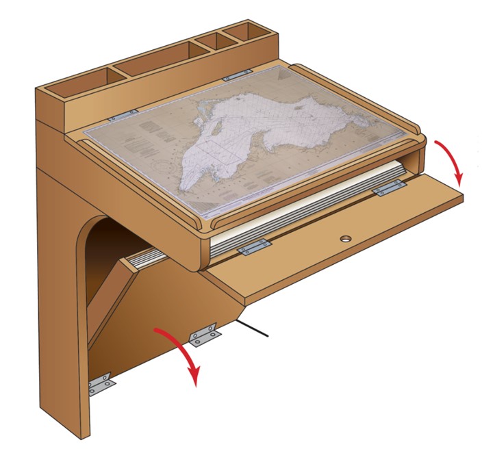
Large boats with nav stations usually have a built-in chart storage area. But for the smaller boat where space is at a premium, charts can be rolled up and stored in a capped, plastic pipe that can usually be stowed in an unused space somewhere on board. The problem with rolled-up charts is that, when laid out for use, they have to be weighted down to prevent them from curling.
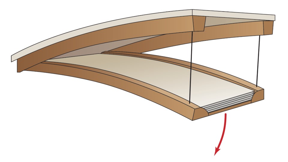
On our schooner, paper charts are stored in a drop-down tray about 3 inches deep that matches the contour of the overhead and is located above one of the bunks. It’s hinged on one side so it can be lowered to the length of its support chains (at an angle of about 45 degrees) to make chart selection easy.
As you may have guessed, I’m not yet ready to abandon my paper charts.
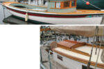
Don Launer, a Good Old Boat contributing editor, built his two-masted schooner, Delphinus, from a bare hull. He has held a USCG captain’s license for more than 40 years and has written five books. His 101 articles through November 2011 are available for downloading as a collection from the Good Old Boat download website, www.audioseastories.com. Look under Archive eXtractions.
Thank you to Sailrite Enterprises, Inc., for providing free access to back issues of Good Old Boat through intellectual property rights. Sailrite.com