Degrees, decimals, and the synthesis of cultures
Issue 82 : Jan/Feb 2012
As we go about our daily rounds, whether on land or sea, it’s critically important that we be able to identify and describe exactly where on earth we are, where we’re going, and what places we’ll pass through along the way. We improve the odds of doing that successfully by using latitude and longitude to pinpoint any location on earth . . . the more accurately the point is identified, the better.
Machines, such as GPS receivers, report this information very accurately. But, strangely, the format used to report latitude and longitude is not standardized.
You are quite likely to encounter a mix of formats as you research your next trip. If you misread a format, you can induce a large and potentially dangerous error (see “A caution on coordinates,” page 47). Make sure you know what format you are looking at so you read and plot positions correctly.
The three most common formats look like this:
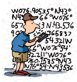
Degrees Minutes Seconds (DMS): N 43o 32′ 12.66″ W 076o 54′ 19.26″
Decimal Degrees (DD): N 43.53685o W 076.90535o
Degrees Decimal Minutes (aka GPS coordinates): N 43o 32.211′ W 076o 54.321′
Each set of coordinates identifies the same location, so why have we developed three systems of expressing it?
Sumerian sums
A very long time ago (about 6,000 years) the Sumerian culture evolved in Mesopotamia, in present-day southern Iraq. The Sumerians used a base-60 numbering system (base-60 in shorthand) in which a unique symbol represented each of the first 60 integers (just like we have unique symbols to write the first 10 integers of our base-10 number system: 1, 2, 3, 4, 5, 6, 7, 8, 9, and 0).
Base-10 allows 10 items to be easily divided into 2, 5, or 10 piles. To break 10 things into 3, 4, 6, 7, 8, or 9 piles takes fractions (which weren’t yet invented). This can be a real problem when dealing with the division of things not easily broken apart, such as jars, workers, or livestock. Using base-60, however, allows 60 items to be easily divided into 1, 2, 3, 4, 5, 6, 10, 12, 15, 20, 30, and 60 piles. Here, the first six divisions are perfect and there are enough initial items that, with a little creativity, most other divisions can be made to work with minimal waste (leftovers). For example, withholding only 4 items allows the remaining 56 to be broken into 7 equal piles. Most historians say that the advantages of using base-60 for trade, particularly for the division of goods, is so great that this fact alone would explain its frequent use in the ancient world.
The Sumerians built huge cities, developed irrigation systems, formed an administrative structure, supported a legal system, and even invented a postal service. Yet we know relatively little about the origin of the Sumerians and even less about the culture that preceded them. A popular theory holds that two earlier peoples merged and formed the Sumerians. The theory proposes that one group used a base-5 numbering system and the other a base-12 numbering system. When the two groups traded together, they evolved a system that used base-60 (also called a sexagesimal numeral system) so both groups could easily understand it (just like getting common denominators before adding or subtracting fractions). It seems easy to believe that a base-5 numbering system evolved from counting the fingers and thumb on a human hand. J.J. O’Connor and E. F. Robertson of the University of St. Andrews in Scotland propose that a base-12 numbering system comes about by counting finger segments: 3 segments on each of 4 fingers . . . while ignoring the confusing 2-segment thumb.
Regardless of exactly why the Sumerians adopted base-60 for their math, it is fairly clear that the Babylonians inherited it from the Sumerians, although another culture, the Akkadians, may have had a role in all this too. Around 2300 B.C., they invaded the Sumerian Empire, held power for a couple of hundred years, invented the abacus, and were eventually overthrown.
Within a hundred years, the Sumerian influence waned, and by 2000 B.C., Babylonian invaders were in solid control of the region. The Babylonians are famous for their astronomical observations and calculations that were greatly aided by the invention of the abacus. Babylonians also invented writing and recorded their findings in an alphabet known as cuneiform by using a wedge-tipped reed stylus to make marks on soft clay tablets. They hardened the tablets in the sun, creating a permanent record. Some of these tablets still survive today.
Days of the heavens
When the Babylonians observed the skies, they noted that every 360 days the heavens repeated themselves except for a few “omen stars,” which we now know to be planets, comets, and the very rare supernova. This was a huge finding for them, as 360 is divisible evenly by 60, and we have already noted how easy it is to divide 60. One can imagine that this all seemed perfect and divine to the Babylonians. They formed a calendar as far back as 2400 B.C. that divided the year into 12 months of 30 days each: 360 days total. One may wonder why they didn’t choose 6 months of 60 days each. Most historians credit the long-recognized four seasons for this, into which 12 months, but not 6 months, can be evenly divided.
After the Babylonians noticed the circular track of the sun’s annual path across the sky and discovered that it took 360 days to complete one circuit, they invented a 360-degree circle representation to record and describe their astronomical findings with each degree representing one day. This told them what had been observed and allowed them to predict very accurately what would occur. Considering the instruments of the time, the division of a circle into degrees was very detailed work indeed. Remember, this all happened more than 4,400 years ago.
Later, the Egyptians determined that the Babylonians were off by five days when counting a full year. So entrenched was the convention that 360 days equals a year and so easily does it divide the seasons, the Egyptians chose to have a five-day holiday once a year and otherwise ignore the problem. But the Egyptians did worry about a different problem.
Around 1500 B.C. (900 years after the Babylonians divided the circle into degrees), Egyptians divided the day into 24 hours. Originally, the hours varied with the seasons. Later, Greek astronomers made the hours equal. Then, between 300 and 100 B.C., the Babylonians subdivided the uniform hour using base-60: 60 minutes in an hour and 60 seconds in a minute. Originally, the term minute was just a description of one small piece created by dividing something into smaller parts (60 parts when your numbering system is base-60). Seconds were a second division into even smaller parts. The thing being divided could be a pile of wheat, a stack of coins, a length of rope, an hour of time, or a degree of a circle. So, while the degree and the hour were invented hundreds of years apart, they were ultimately divided in the same manner and inherited the same names of division: minutes and seconds.
Degrees of separation
A more subtle association occurred too: angles (divisions of a circle) became associated with locations on earth and travel east or west: longitude. This tied together the ideas of using degrees, minutes, and seconds to describe where you were (longitude) as well as where you were heading (angles). While we are repeatedly taught that New World explorers following the Medieval Period (Christopher Columbus, for example) feared sailing off the edge of a flat world, in reality, educated ancient people knew the world was round in all directions (a sphere). In fact, many early scientists made efforts to measure its size based on their local observations of the earth’s curvature. Aristotle (384-322 B.C.) wrote that a round earth was common knowledge among the educated, and Eratosthenes of Cyrene (276-195 B.C.) calculated the circumference of the earth to less than 1 percent error. It is likely that the earth’s spherical shape was known much earlier.
Knowing the earth was a sphere meant that travel north or south could be measured in the same degrees, minutes, and seconds of a circle as one used for travel east and west, since a sphere cut in half results in a circle whether cut along the equator or cut north to south. A circle that goes through the north and south poles is called a meridian, or line of longitude. A location along a meridian tells you how far north or south of the equator you are (your latitude). Lines of equal distance north or south of the equator (lines that run around the globe due east and west) are called lines of latitude. Knowing where you are along one of these lines tells you how far east or west you are of a special meridian, the Prime Meridian, and tells you your longitude.
While the equator, midway between the two poles, is an obvious choice for the starting line of latitude, the choice for the first line of longitude has never been as clear. That line, called the Prime Meridian, has been placed in various locations throughout history. Today we use a meridian that passes through the Royal Observatory in Greenwich in southeast London, United Kingdom. But it could run through any point on earth and be just as accurate and useful.
Difficulty of degrees
While degrees and minutes work reasonably well to identify or record a given angle, heading, or location, doing basic math (addition, subtraction, multiplication, or division) with them can be a confusing mess: 40 seconds plus 40 seconds isn’t just 80 seconds, it’s 1 minute and 20 seconds; 2 minutes minus 10 seconds requires an awkward carry to yield 1 minute and 50 seconds; and so on.
On the other hand, basic math is comparatively easy using base-10 (like decimal degrees). While this is true for human mathematicians, the real payoff comes when one uses base-10 numbers with a computer.
This simplicity is even more important when computers perform complex calculations, like trigonometry functions, for which they use a mathematical formula called an infinite series. If you need lots of decimal places of accuracy, then a large number of terms in the series need to be calculated, each involving a rapidly increasing number of simple calculations. Soon, the computer is doing a huge number of simple calculations just to calculate one accurate trigonometry result. It takes time and computer memory to do this in base-10. It becomes almost impossible using base-60.
In reality, the computer is also converting back and forth between base-2, called binary, and base-10. Binary just isn’t human friendly no matter how basic it is to computer operations, so input to and output from a computer program is designed to be in base-10 format. The computer can be programmed to further convert input and output into other formats (like degrees, minutes, and seconds), but this takes additional computer time and resources, so there is a fair amount of resistance to making these additional conversions.
Digital divisions
In summary thus far: degrees, minutes, and seconds can be traced back to the Babylonians and why and how they divided up a circle. They also originated the idea of using the divisions of circles to describe where on earth things were and figured out how to record such data (the invention of writing).
Much later, the routine use of decimal degrees resulted from the routine use of digital computers. While limited use of decimal degrees may have existed before, common sailors didn’t see this format in use until electronic navigation equipment containing computers showed up in their own cockpits.
More recently, a third system has come into favor: degrees and decimal minutes reported to thousandths of a minute. Since most modern GPS receivers use this format, these are commonly referred to as “GPS coordinates.” In an odd twist, it wasn’t sailors who established the popular use of this format but airplane pilots, who borrowed an earlier nautical system.
After altitude, pilots worry most about heading, which is basically an angle (the angle between north and where one wants to fly). Headings were originally followed using a compass. Later, navigation was refined by having ground-based radio transmitters send out signals that instruments on the plane could use to figure out where they were and, with multiple readings, where they were heading. The basics were developed during World War II but have been much refined as computing power, electronic precision, and radio-frequency use have improved.
One common system is called VOR (short for Very High Frequency Omnidirectional Radio Range). The direction from the station to the aircraft, in degrees from local magnetic north, is called the radial. The “intersection” plotted on a chart of two radials from different VOR stations provides an approximate position of the aircraft. This process is called triangulation. Originally, the instrument looked a lot like a compass dial and could, at best, be read in full degrees.
Then the LORAN system came into use. This system was developed for mariners but quickly became the standard of pilots. Unlike VOR, LORAN doesn’t offer distance and radials to triangulate one’s position, but instead reads out latitude and longitude coordinates directly. The earliest units reported in degrees and full minutes (no decimal minutes yet). Knowing where you were by reading a point displayed on an accurate instrument was a great deal simpler than working out triangulations on a map based on multiple VOR sites.
LORAN is similar to GPS except the signal transmitters, instead of space-based, are ground-based. While this makes it easy to know where the signal came from (unlike with satellites, which are in motion), it leaves signal dead zones. Since LORAN was developed for nautical use, dead zones originally included the entire middle of the United States. Additional transmitters helped remove many, but not all, dead zones.

LORAN instruments could keep track of readings and read out direction and speed of travel. Given a destination, they could provide lots of information, such as headings, drift, and arrival times. As more stations were established and electronics became more accurate, so too did the information LORAN provided. Before long, units could provide readings accurate to tenths of minutes. They didn’t use seconds because counting tenths of minutes in seconds is quite awkward: 0, 6, 12, 18, 24, 30, 36, 42, 48, and 54 seconds.
Later, the accuracy improved to hundredths of minutes (about 61 feet or better). Hundredths of minutes (100 divisions per minute) offer almost twice the accuracy of seconds (60 divisions per minute). At this point in history, the instrument field might have been able to return to the ancient degree, minute, second format. However, it would have nearly halved available accuracy, taxed computers to make another level of conversions, and produced a non-decimal format that didn’t favor hand calculations.In practice, few practical hand calculations deal with distances so long that they require dealing with degrees. Most involve only a few minutes and the decimals of minutes.
Airport and facility directories offer critical airport information to pilots, since pilots typically fly from and to airports. One critical piece of information is the airport’s location. By the mid-1990s, this information was dutifully reported in degrees and decimal minutes to hundredths of a minute.
Heavenly bodies
The LORAN system might have simply been improved indefinitely, but the U.S. military wanted something less susceptible to being switched off or destroyed. The solution was simple:use LORAN technology but have the transmitters in orbit where they would cover the whole world, be out of reach of most countries, and be in motion so even low-coverage areas would be periodically covered.
In 1978, the first experimental Block-I GPS satellite was launched. By 1985, 10 more experimental Block-I satellites had been launched to validate the GPS concept. In April 1995, full operational capability was declared (about the same time that LORAN started routinely using hundredths of a minute).
Initially, the highest quality signal was reserved for military use only. The signal available for commercial and civilian use was intentionally degraded. This was called Selective Availability (SA) and limited the accuracy of civilian GPS units to less than that of LORAN. It changed when President Bill Clinton ordered Selective Availability turned off at midnight May 1, 2000. This improved the precision of civilian GPS from about 1,000 feet to about 65 feet (about a hundredth of a minute, which is what LORAN had been using).
Turning off Selective Availability made GPS the overnight favorite for navigation for groups as widely different as pilots, boaters, and hikers, but these groups routinely needed still more accuracy.
The Wide Area Augmentation System (WAAS) is an air-navigation aid developed by the Federal Aviation Administration (FAA) to augment the GPS. Its implicit goal was to improve accuracy, integrity, and availability of GPS. WAAS was intended to enable aircraft to use GPS for all phases of flight, including precision approaches to any airport within its coverage area.
WAAS uses a network of ground-based reference stations to measure small variations in the GPS satellites’ signals. Measurements from these reference stations are used to determine corrections to offset the GPS errors. WAAS-enabled GPS receivers then use these corrections while computing their positions to improve their accuracy.
On July 10, 2003, the WAAS signal was activated for general aviation, thus covering 95 percent of the United States (less Alaska). Actual WAAS system performance measurements have shown that it typically provides better than 3-foot 3-inch accuracy throughout most of the contiguous United States and large parts of Canada and Alaska. In preparation for this improved accuracy, manufacturers of civilian GPS receivers added another decimal place to the degrees, fractional-minute format: thousandths of a minute (about 6 feet).
Today pilots, boaters, hikers, automobile drivers, surveyors, and many more commonly use GPS coordinates: degrees and decimal minutes reported to thousandths of a minute. But anyone who frequently uses maps, charts, and other navigation aids (even older GPS receivers) will also encounter the decimal degrees (DD) that computers like and the degrees, minutes, seconds (DMS) that ultimately stretch back to when writing was invented. The need to convert between these formats arises as well . . . and it all started because 6,000 years ago traders needed to divide goods into even piles.
Devin Ross sailed his O’Day 25, Huguenot, on Lake Erie for three years before moving her to Lake Arthur in Moraine State Park, Pennsylvania, to allow him to make easy day trips (and get in many more sailing days). Huguenot is the latest in a progression of boats: a Hobie 16, an Erie 17, and a South Coast 22.
Thank you to Sailrite Enterprises, Inc., for providing free access to back issues of Good Old Boat through intellectual property rights. Sailrite.com