Electronic charts offer choices for every budget
Issue 41 : Mar/Apr 2005
The typical chart plotter consists of a display unit, either black-and-white or color, and a GPS. The plotter displays your boat’s position as a symbol superimposed on an electronic chart. This symbol is frequently boat-shaped with a small dot in the center. That dot shows your position.
Electronic chart plotters come in a wide range of sizes, options, and prices and are available as either hand-held or fixed-mount. While some systems’ sole function is to provide an electronic chart, the majority are integrated with a GPS receiver. Sometimes an external GPS is interfaced with the dedicated plotter, using NMEA protocol. More often, since there are no universally accepted standards for the chart display, most manufacturers of chart plotters use a proprietary electronic format. Thus, your choice of a manufacturer determines the type of chart cartridges that can be used, the software, and the display options.
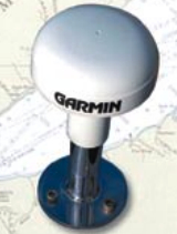
Some of the basic requirements of GPS chart plotters are that there should be a fast processor and at least a 12-channel GPS receiver with WAAS, which should provide a repeatable accuracy of location within about 10 feet. The GPS antenna should be located out in the open as much as possible, since the short wavelengths and low power of the GPS signals don’t easily pass through metal, fiberglass, or people.
The LCD raster display should be easily viewable in direct sunlight, and the chart display should be capable of being oriented in “north up” or “course up.” Although units with color displays are considerably more expensive than monochrome, they provide substantially better apparent resolution and, because of the color differences, it is easier to differentiate between land, navigable water, and shoal water. Most units feature automatic track plotting, so a track is saved on your outbound and return voyages. At night or during inclement weather, the outbound track can be followed for a safe return.
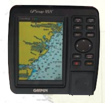
Hand-held plotters are often able to save more than 20 routes and 50 waypoints. Fixed units usually can store more than 1,000 waypoints. Variable scaling, or the ability to zoom in and out, should also include a scale showing distance in miles, nautical miles, or kilometers. When heading for a waypoint, distance, direction, speed, and estimated time of arrival should be prominently displayed. The ability to measure range and bearing to any point on the chart is also important.
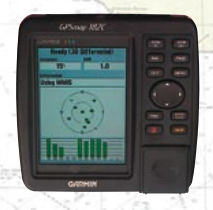
There are basically two forms of electronic charts, raster charts and vector charts. Raster charts are scanned images of NOAA government paper charts and, as a result, have some limitations in their electronic capabilities. Vector charts start as scanned images of the NOAA charts, but the data is stored in “layers,” giving the user options in eliminating specific data layers that are not of interest.
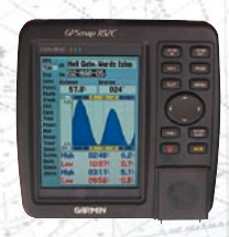
In the recreational boating electronic industry, three software formats have come to dominate the chart-plotter market: Garmin BlueChart, C-Map, and Navionics.
Garmin BlueChart chips provide a display that looks very similar to paper charts, but with a single keystroke additional information on marinas, tides, and hazards is available. The operator can also overlay and store waypoints in the chart display. These vector-based BlueChart charts are available on a CD and can be downloaded into a fixed or hand-held plotter from a laptop or desktop computer.
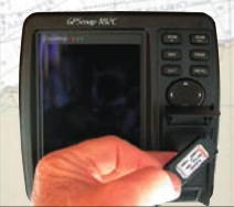
C-Map is a vector-based chart system that provides such features as an alarm when the vessel is approaching shoal waters and a search mode for locating harbors and services.
Navionics cartridges cover large areas; only 17 are required to cover the entire U.S. coastal and Great Lakes waters. Also vector-based, these chart cartridges are available in the “Gold format” for various chart-plotter manufacturers, including Furuno, Lawrence, Raymarine, Northstar, Eagle, and Humminbird.
Dedicated chart plotters feature only the chart and GPS displays. They are high-resolution LCD displays in either black-and-white or color with the vessel’s position superimposed on the chart.
Combination chart plotters, made by several manufacturers, also give the chart and GPS fix, but may also offer more than one service on the same screen. These additional displays might include a fishfinder, depthsounder, and radar. Some manufacturers have the capability of displaying the picture from an external video camera or even your favorite movie. In some combination chart plotters the display can also be routed to a remote monitor. Many of these combination chart plotters have the ability to include expanded coverage for future accessories.
Laptop or desktop computers on board can use a variety of computer programs to display charts with excellent resolution onto a screen larger than that available with cockpit chart plotters. Their disadvantage is that, with a few expensive exceptions, they are not resistant to spray, are not easily mounted in place, often cannot be comfortably viewed in direct sunlight, and can rarely be seen by the helmsman. For the on-board computer, there are software chart packages available in various formats. Several options are available, such as Offshore Navigator’s interface that allows your computer to drive your autopilot.
Prices of chart plotters vary between about $600 for a black-and-white low-end unit and about $18,000 for a top-of-the-line combination-display model.
Wireless technology and solar power for navigational instruments is now expanding in the marketplace. By using radio-frequency signals and built-in solar panels, these new instruments can be installed as either primary or remote monitors with no cables whatsoever.
Thank you to Sailrite Enterprises, Inc., for providing free access to back issues of Good Old Boat through intellectual property rights. Sailrite.com