What advertising and operating manuals don’t tell you
Issue 73 : Jul/Aug 2010
Retrofitting your good old boat with a new GPS receiver? A GPS chart plotter? Beware. Whatever the salesman told you, whatever you learned in the advertising and promotion, whatever you read online and in the owner’s manual — it’s not the whole story. Caveat emptor.
A GPS system can steer you into trouble just as easily as it steers you toward your destination. Yes, GPS technology is mature and reliable, it’s accurate to less than 10 feet, and it’s easy to use. But there are serious pitfalls and risks associated with GPS, as any knowledgeable skipper will testify.
These important points are worth your consideration:
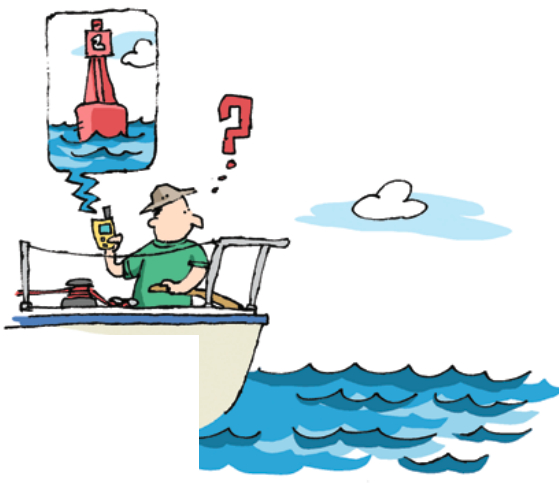
▶GPS cannot show you where the navigation aids actually are, just where they should be. The buoy charted at position N 41° 48.872’ and W 70° 27.609’ may not be there. Since your GPS receiver was programmed, the buoy may have been relocated or removed (whether deliberately or accidentally). Verify the buoy’s position either with data updates or visually as you pass near it. In fact, the data that constitute your plotter’s charts should be updated periodically. Chart updates are free from NOAA or available in an organized way on CD from the folks at .
▶ GPS cannot show you what’s actually at a waypoint, only what’s supposed to be at a waypoint. So you may get to the waypoint just as other vessels are also approaching the waypoint. Or the buoy may be a convenient reference point for fishermen who have anchored or are drifting in the area. In other words, if you let the GPS system drive your boat’s autopilot, keep a sharp lookout at the same time. You may be heading for an unpleasant surprise.
▶ Beware of the potential hazard associated with reciprocal courses between popular GPS waypoints. When you are en route to a popular waypoint, consider that other boaters are likely to be using the same waypoint. Some are going toward it; some have just left and are headed your way. To avoid the prospect of close encounters on reciprocal courses, I don’t drive my vessel precisely down the rhumb line between two waypoints. Instead, I run parallel to the rhumb line a short distance (say 100 to 200 yards) off to starboard, ignoring the GPS system’s warning about cross-track error. If the other guys coming my way are doing the same thing, the rhumb line serves as a virtual highway median.
▶ GPS cannot warn you of floating hazards that are not “in the system” — debris, crab pots, fish traps, swimmers, kayakers, floats marking shellfish beds, and yacht-race buoys. These and countless other objects floating on the surface and just below it must be avoided. You cannot rely on GPS to help you steer clear. The advice to keep a good lookout is much more relevant. You may need to steer a crooked course before returning to the GPS-directed compass course or bearing to the waypoint.
▶ With GPS waypoints and routes, you may not be able to go from here directly to there. In your car, you program your GPS unit to take you to a single waypoint, the destination. The GPS computer calculates the route, then signals the turns and distances en route, updating itself as progress is achieved. However, your marine GPS has marine software. Enter a single destination waypoint in your boat’s GPS and you may be shocked to find that your GPS directs you across dangerous shoals and reefs — and even peninsulas and islands. Your marine GPS calculates a straight line (the rhumb line) between two waypoints. It differs from your car GPS in that it is not capable of routing you through one or more turns to the ultimate destination. You must give it one or more interim waypoints that will route you around the island, reef, or peninsula. You must identify and select each of these waypoints, enter them into the GPS memory, and then assemble these waypoints into a route. Only then will your marine GPS follow the turns to your destination safely.
▶ GPS cannot alert you to hazards that develop when rain, fog, and darkness reduce visibility. This is the role of radar, rather than GPS. Some chart plotter models combine the two functions on a single display, overlaying radar images on the GPS display. This is a great advance in navigation technology.
▶Some nav aids should never be entered as waypoints in a GPS, such as lighthouses, towers on the ends of breakwaters, mile markers and stakes on the ICW, and skeletal towers perched on rock piles. Entering such nav aids in your GPS tempts the helmsperson to head directly for (and pass as closely as possible to) the navaid, turning it into a hazard. As GPS waypoints, I recommend only floating nav aids, especially big buoys with bright lights and sound-emitting devices such as horns, bells, and whistles. If you get too close to one, you’ll see it in time — or bounce off.
▶All GPS routes and waypoints must be saved — preferably on paper — but at least in a separate electronic device, such as your computer. One of these days, when you are most in need of navigation assistance, the waypoints and routes that you painstakingly and carefully installed in your GPS system will be unavailable. Someone (you, perhaps) will have inadvertently deleted them. A backup file will be your salvation.
▶Do not blithely steer to waypoints or follow routes that were previously installed on your GPS unit by the manufacturer, the salesman, your brother-in-law, or the boat’s previous owner (PO). Especially the PO. He may have sold the boat because, following a faulty route that was sloppily planned, he steered across a shoal or mudflat or reef and damaged the boat. Probably damaged his ego too. If there are waypoints and routes in the GPS when you acquire it, verify their accuracy and safety before setting out. My advice is more deliberate. Delete those untrustworthy routes and waypoints (many of which you’ll never use anyway) and create your own.
▶Keep your GPS and chart plotter up to date. The newer ones automatically download chart updates and software updates when in range of wireless Internet service. Failure to update older systems periodically is dangerous because, over time, buoys are re-numbered, added, moved, and removed; deepwater channels and shorelines are shifted by storms and currents; and underwater dangers and obstacles are found in the most unlikely places. Furthermore, some cruisers have found that the charts still in use were never accurate to begin with. The islands haven’t moved, but the accuracy of today’s GPS exceeds the accuracy available to the original cartographers. Keep this in the back of your mind any time you cruise beyond your home waters.
▶Take time to honor tradition. When planning a series of GPS waypoints and a route to a new destination through unfamiliar waters, do it on a paper chart first. With a pencil. Look for hazards to be avoided, such as fixed nav aids, reefs, and shoals. These hazards are more easily observed on a traditional chart. Route your boat safely around them. Also note the compass courses, distances, and the prominent nav aids that will constitute waypoints along your route. Then transfer these data from the chart into your GPS unit. Save everything including the paper chart; it may be pressed into service as your backup navigation tool.
▶ Learn how to use virtual waypoints. Unlike GPS receivers for highway use, with your boat’s GPS any intersection of latitude and longitude can be assigned and labeled as a waypoint. Such intersections are, quite literally, everywhere, so a waypoint needn’t be where a buoy is located, it could be between buoys. It needn’t be at the jetties marking the entrance to your harbor, it could be a fourth of a mile to seaward of them. Note the position of the desired waypoint, call it a virtual waypoint, and give it a name (Home Harbor Entrance), save it in your system, and add it to your route.
▶ Identify new GPS waypoints by giving them meaningful names. When you create a new waypoint, your GPS will automatically assign it a three-digit numerical code in sequence (001, 002, and so on). Days or weeks later, these codes will mean nothing to you. You can change these codes to names that are more easily remembered at the time you need them. Instead of 015, you could label the waypoint Port Jeff or PJ, indicating the red-and-white buoy marking the harbor entrance at Port Jefferson, Long Island. Because the sea is not our native environment, everyone on board should be attentive and alert at all times. Even the best navigators equipped with the finest GPS chart plotters and other electronics will welcome observations from the helmsperson and other crew on deck.
Captain Bernie Weiss is a delivery skipper based in Stamford, Connecticut. At Atlantic Yacht Delivery www.AtlanticYachtDelivery.com, Cap’n Bernie repositions sailing and motor yachts between Maine and Florida. He also trains new boatowners. When not at sea, he instructs, lectures, and organizes workshops on electronic navigation, engine maintenance, sailing, and related subjects.
Thank you to Sailrite Enterprises, Inc., for providing free access to back issues of Good Old Boat through intellectual property rights. Sailrite.com