A basic overview just for sailors
Issue 31 : Jul/Aug 2003
One factor dramatcally affecting the performance, comfort, and safety of a sailboat is weather. Sailors can observe, record, and plot weather. However, unlike most other variables that affect one’s sailing, the best one can normally hope for with weather is to attempt to understand it.
In spite of this, even the most casual sailor can recognize common situations heralding weather changes when armed with a knowledge of basic weather phenomena.
Changes in weather, from relaxed, tranquil seas to the most violent storms, are caused by the interaction of different air masses. The leading edge or boundary between two different air masses as they move around the world is called a front.
Fronts, warm and cold
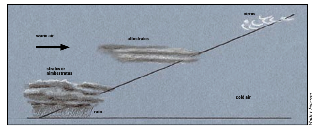
A warm front forms when warm air gradually rises over colder air and begins to cool. Moisture contained in the warm air begins to condense and results in the formation of clouds (see illustration below).
The first clouds to appear, well ahead of the warm front, are delicate, wispy strands of cirrus. This high-level cloud is normally followed by layers of middle-and lower-level stratiform-type clouds (stratus), which are usually thick and cover a large area. These produce widespread precipitation, which may be accompanied by fairly strong winds. Weather of this type may last 24 hours or more, depending upon the rate at which the front is moving.
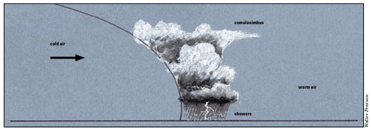
Cold fronts are generally associated with low-pressure systems, and tend to produce more volatile weather than warm fronts. A cold front forms when cold air moves into an area of warm air. The warm-air mass, which is less dense, is forced sharply up and somewhat over the cold-air mass. This action creates instability and very powerful convection (see illustration on facing page).
Very large cumulus clouds and even the “king of clouds,” cumulonimbus, may develop, triggering storms along the entire front. Also, an area of low pressure is created, strengthening the localized winds. The rain showers will be heaviest and the winds strongest along the front. As the front passes, additional showers may develop as clouds form in its wake. The showers are generally short-lived, with dry spells between showers usually lasting longer than the showers themselves.
Pressure, low and high
Air is composed of billions of molecules in constant movement and collision with each other. These molecular collisions are known as air pressure.
When an air mass is warmed, it expands and rises. This expansion reduces the number of molecular collisions, creating an area of low pressure. Conversely, as air is cooled, it becomes denser, causing the air molecules to collide more often. This dense air sinks, resulting in an area of high pressure. Since nature works to restore equilibrium, air moves from high-pressure areas to those of low pressure. This movement is what we know as wind.
As air rises and creates an area of low air pressure, water vapor in the air begins to condense and form clouds. Cooler, sinking air generally means no condensation can take place, and the resultant high-pressure area usually gives rise to clear skies. Fluctuations in air pressure often indicate pending weather changes. For example, rapidly falling air pressure indicates that a low-pressure system is approaching.
While localized high and low pressures can affect weather in a small geographical area, large areas of high or low pressure, called systems, are responsible for more widespread atmospheric changes (that is, brief afternoon showers vs. hurricanes).
A low-pressure system is usually the result of a warm-air mass being forced upward by colder air, such as occurs in the formation of a cold front. Low-pressure systems are usually associated with unstable weather conditions.
More air drawn in
As the warm air rises and pressure falls, more and more air is drawn into the system. This movement of air results in strong winds, which blow counterclockwise around a low in the Northern Hemisphere and the opposite way in the Southern Hemisphere.
In a high-pressure system, cool dense air sinks to the earth, and the resultant winds rotate clockwise around the high in the Northern Hemisphere. Highs are normally associated with stable conditions and clear skies.
If a high is located to the west of a given position, the winds will be blowing generally from the north or northwest. Conversely, if it’s a low to the west, the winds will most likely be coming from the south or southwest. Should a system then track to the north of that same given position, anticipate the wind to shift from a northerly to easterly direction with a high and from a southerly to westerly direction with a low.
Weather-watcher’s toolbox
In addition to having a basic understanding of common weather phenomena, a sailor needs a few simple tools with which to measure and record weather observations:
- A barometer, preferably one with an adjustable reference hand, with which to measure air pressure, as well as to determine a stable, rising, or falling trend.
- A thermometer to measure air temperature.
- Something to measure wind direction: a Windex or telltales and a compass, or a proper windvane.
- An anemometer and/or Beaufort scale to measure or estimate wind speed.
- A cloud chart with which to identify weather-heralding clouds (see section beginning on Page 38).
- A ship’s log or notebook in which to record weather observations.
With these items, a sailboat becomes a fairly well-equipped weather observation/forecasting center. Remember that one or two or even three consecutive observations do not make for an accurate forecast, however. Individual observations are mere “snapshots” of a greater picture.
Weather is dynamic and is always changing, much like a “motion picture” that shows scene after scene after scene. As such, an accurate forecast, is based on what has been happening and what is happening, as well as an abundance of “cause and effect” historical data.
One of the most significant and helpful tools in a sailor’s weather forecasting arsenal is a cloud-identification chart. This is a high-powered “cause and effect” (or, more correctly, a “cause and anticipated effect”) tool.
Formation of clouds
Simply stated, when condensation takes place above the earth’s surface, clouds form. Normally, air temperature decreases with increasing height. Therefore, clouds that form at high levels tend to be made of ice crystals, while those forming at the lowest levels normally consist of water droplets. Middle-level clouds may be composed of a mixture of water droplets, ice crystals, and supercooled water droplets. The exact type of cloud depends upon such factors as the amount of moisture in the air, the amount of uplift, and the degree of atmospheric stability.
High-level clouds form above 16,500 feet. They are called cirrus or have a “cirro-” prefix. Middle clouds occur between 6,500 feet and 16,500 feet and usually carry the “alto-” prefix. Low clouds form below 6,500 feet and have no prefix. They have their own names, such as cumulus and stratus. One exception is cumulonimbus, which inhabits all three levels of the atmosphere. It is included with low-level cumuliform-type clouds because it develops out of such formations. The sky can be embellished with more than 100 cloud combinations, making for endless possibilities and a host of atmospheric events. This vast array of clouds has been distilled here to less than a dozen “predicting clouds.”
Summing it up
When the sky overhead has a certain look, quite often a sequence of atmospheric events, or “weather,” follows. However, there is nothing certain about it. Sometimes the weather suggested by the look of the sky will develop true to form, sometimes not.
Remember, weather is affected by myriad things including seasonal factors and local topography. If bad weather is anticipated, it’s better to assume it will arrive sooner than expected rather than later, especially if you’re on the water.
Cloud Chart
(Note: Asterisks following captions indicate ancient weather proverbs.)
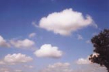
Cumulus clouds usually appear in the late morning or early afternoon. They develop as the result of weak, localized convection, in which surface air, in contact with the sun-warmed earth, warms up and rises into the atmosphere. In this cool upper environment, the water vapor in the previously warm air condenses, and a cloud is formed. Cumulus clouds resemble small cotton balls, with small rounded tops and flat bases at around 2,000 feet. These clouds are often referred to as “fair-weather Cumulus (congestus). “A round-topped cloud, with flattened base, carries rainfall in its face.” * cumulus” and normally indicate no immediate change in weather. The winds associated with them are usually light to moderate, with daytime readings of 4 to 10 knots and 1 to 6 knots at night. Temperatures will be highest in early afternoon and coolest at dawn. The barometric pressure will normally be steady or may rise slowly.
While this form of cumulus is associated with fair weather, should it continue to build rapidly, you may want to be prepared to reduce sail area.
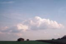
This advanced form of cumulus (at right) is taller than it is wide. Its development is associated with atmospheric instability, in which the temperature of the surrounding air drops more rapidly. This form of cumulus is capable of generating heavy and prolonged showers. If the winds are blowing between southwest and northwest, precipitation and gusty winds or wind squalls without precipitation are likely in 4 to 8 hours. Should the cloud become darker, it may grow into cumulonimbus. Time of day is a deciding factor. If cumulus is the tallest cloud in the sky by late afternoon, it is unlikely that it will progress to cumulonimbus. However, if the color darkens and vertical development increases in the early afternoon, expect squalls within 1 to 3 hours.
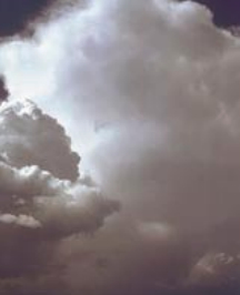
Cumulonimbus is a tall, heavy, and dense cloud. While its base is near 2,000 feet, its top routinely reaches 30,000 feet and, upon occasion, as high as 60,000 feet. It is often referred to as the “king of clouds.” The formation of cumulonimbus can begin early in the morning as simple cumulus. In order for this to occur, powerful convection must combine with atmospheric instability. This combination produces vigorous updrafts that force the cloud up into the highest levels of the troposphere. Distant cumulonimbus clouds often show an anvil-shaped cirroform top.
If cumulonimbus clouds are present, especially if the winds are coming from the southwest through north, batten down the hatches, stow loose items, reduce sail, and don foul-weather gear. If close to sheltered waters, head for them. Winds of 18 to 28 knots, with gusts up to 40 to 60 knots, can be anticipated, along with thunder and lightning, heavy showers, and possibly hail. Unlike the long-lasting, widespread rain associated with stratiform-type clouds, these showers will be localized and may last only minutes. A large temperature drop can accompany the storm cell, and visibility may fall to a half a mile or less. A slowly falling pressure, more rapid with worse storms, will also occur.
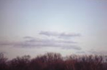
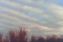
Stratocumulus typically forms when stable layers in the atmosphere retard the vertical development of cumuliform cloud and channel its development horizontally. Thus, stratocumulus and cumulus are frequently seen together in the same sky. Stratocumulus is usually white or somewhat gray and forms in patches, sheets, or layers. It has a ragged appearance along its upper surface, but has well-defined, flattish bases, developing between 2,000 feet and 6,500 feet.
These clouds are commonly observed in conjunction with stable high-pressure areas and normally is an indicator of no change in weather type. Winds associated with this low cloud are normally light to moderate, with daytime readings of 4 to 10 knots and 1 to 6 knots at night. Relatively warm temperatures and little change in pressure are usually experienced.
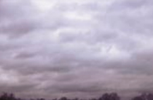
Stratus clouds are generally very low (below 6,500 feet) in the sky. They are usually a gray layer with a fairly uniform base and result in overcast conditions. Stratus clouds often form when a mass of warm, moist air rises over the surface of a warm front. Since these clouds normally cover a wide area, any precipitation tends to be widespread and relatively long-lasting. Stratus that gives rise to significant precipitation is known as nimbostratus. Winds from the northeast to south may bring heavy rains, while winds from other directions may only bring light drizzle or just an overcast sky. The visibility with low-lying stratus may be 1⁄2 to 2 miles, the temperature is normally steady with high humidity, and the pressure is also steady or possibly falling.
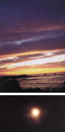
Altostratus is a middle-level, featureless cloud, ranging from a thin veil to a dense gray mantle. A middle cloud, its base is at around 6,500 feet. It can be an extensive cloud deck and may extend over hundreds of square miles. Altostratus is formed by the lifting and condensation of a large air mass over the top of a warm front.
At a minimum, it produces an overcast sky. However, if it’s sufficiently thick, it becomes the forerunner of nimbostratus, which produces widespread, steady rain, especially if the winds are steady from the northeast through south. This cloud is an indicator of moderate deterioration of weather conditions. At its worst, it can bring winds of 15 to 20 knots, cooler temperatures, and a falling barometer.
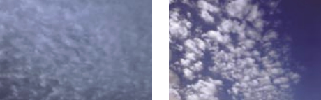
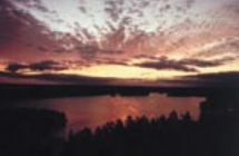
Altocumulus is a middle cloud most commonly occurring in the form of a layer of fairly regularly arranged “cloudlets.” It is formed by the lifting of an air mass, followed by condensation combined with instability. Altocumulus is normally a sign of fair weather and possibly just an overcast sky. However, if altocumulus thickens to more of a washboard appearance, light rain, heralding an approaching front, is likely in 16 to 24 hours. This can be anticipated if the winds are steady from the northeast through south.
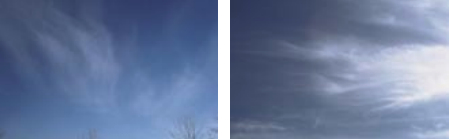
(Forecast: good weather, perhaps the approach of a warm front.)
Cirrus. This high-level cloud appears as delicate, wispy strands that often stretch across the sky. Its base is at 16,500 feet and its presence indicates moisture at high levels. Cirrus is the highest of all clouds and is composed of ice crystals.
There’s a fine day in store if the winds are from the west through north and the cloud is isolated or very wispy in appearance. Visibility will be more than 10 miles with light to moderate winds of 5 to 15 knots and a barometer showing little change.
Cirrus clouds typically form on the leading edge of a frontal system. Precipitation within 24 to 48 hours is likely, especially if the cloud changes to cirrostratus or cirrocumulus or if the winds are from the northeast through south.
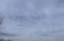
Cirrostratus is a high, even-layered cloud that can cover a wide area of the sky. It is formed by the saturation of a large air mass at high levels.
A darkening and thickening of the cloud layer may indicate the approach of a frontal system. Expect precipitation in 24 to 48 hours, if the winds are steady from the northeast through south, or sooner, if they’re blowing from southeast through east. Watch the rate of barometric pressure fall, as another indicator of how soon to expect the rain. The faster the pressure falls, the sooner you can expect the rain.
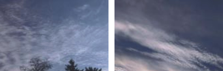
Cirrocumulus, like cirrostratus, forms because of the saturation of a large air mass at high levels. However, unlike cirrostratus, instability at cloud level gives cirrocumulus its cumuliform appearance. It can stretch for hundreds of miles across the sky, often appearing as a fine rippled pattern, said to resemble the scales of a fish.
As the old mariner’s saying goes — “Mackerel sky, mackerel sky, not long wet, not long dry” — cirrocumulus is an indication of an approaching frontal system. Precipitation is likely in 12 to 18 hours, especially if the winds are from the northeast through south.
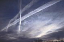
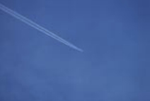
Contrails. Aircraft operating at high levels (above 16,500 feet) emit water droplets from their exhausts. Since the air temperature at these levels is normally well below freezing, these water droplets form ice crystals and create an artificial cloud. The term “contrails” is short for condensation trails.
If the surrounding air contains little moisture, the contrails will be short-lived and invisible from earth. However, if the surrounding air is close to saturation, the contrails will be much more noticeable and can last for 45 minutes or more. These long-lasting contrails indicate an approaching frontal system.
Thank you to Sailrite Enterprises, Inc., for providing free access to back issues of Good Old Boat through intellectual property rights. Sailrite.com