Seeing current requires GPS and a knotmeter
Issue 107 : Mar/Apr 2016
I grew up sailing on a lake in upstate New York on a 16-foot hand-built wooden sloop. No tides. No currents. Only wind. No instruments — just sails and rigging, rudder and tiller, cleats and centerboard . . . observation and “feel” . . . sensory connections.
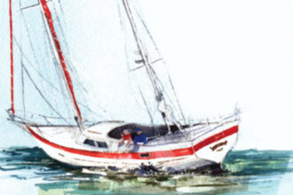
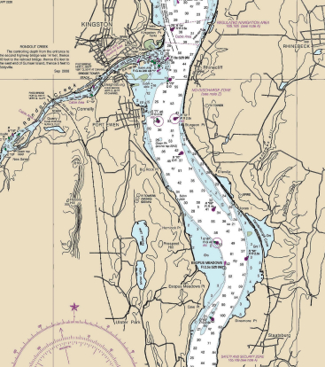
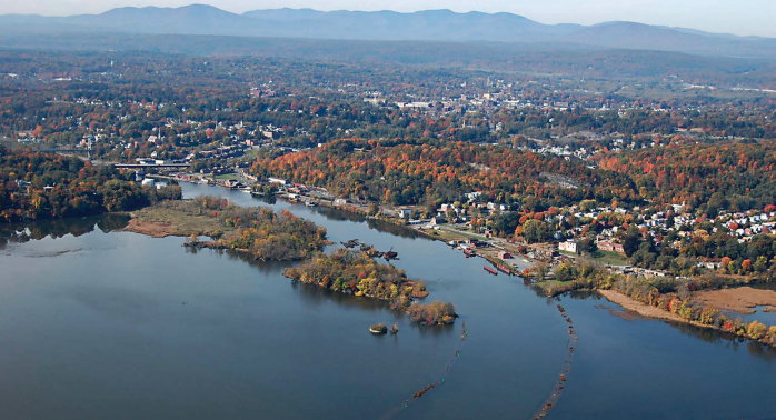
About 15 years ago, my husband and I bought a sailboat we dock at a marina on Rondout Creek, a tributary of the Hudson River. We’ve made the trip south to Florida and back with that boat and, now, a larger boat. I work at the marina on the Rondout too. Here, and in our travels, we have learned much about tides and currents and about tools like charts and depth sounders, compasses, knotmeters, and GPS . . . technological connections. We have learned to enhance our senses with the electronics.
The Rondout is fresh but tidal, with a normal tidal range of 4 feet, even though we are more than 100 miles from the Atlantic. With “normal” rainfall and “average” weather, the creek mimics the Native American names for the Hudson, Mohicanituck and Shattemuc: “great waters in constant motion;” “the river that flows both ways.” At ebb tide, water flows downstream at an average maximum velocity of a bit more than 1⁄2 knot; at flood tide, water flows upstream at just under 1⁄2 knot on average. On the Hudson, the tidal currents are stronger, averaging 1.5 knots at flood and 1.8 at ebb.
When I was growing up, upon setting out for a daysail on the lake, we sailed upwind first (we had no motor), planning to beat until the designated turnaround time and then run home. Sometimes the wind died, sometimes it switched, but this plan was pretty successful.
Now, we motor the mile to the Hudson, check the tides, check the wind, and decide which way to go. Sometimes we spend an enjoyable day without making headway north or south, but achieving a steady 5 knots over water, tacking across the river.
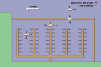
With a west wind, we thrill to travel easily along the length of the river and check the difference between the speed readings on our GPS (speed over the ground) and knotmeter (speed through the water) to verify how fast we think we are going based on the heel and feel of the boat, the landmarks on shore . . . technology augments sensory connections.
Water in motion
Tides are not the only current influence here. Rondout Creek gathers waters from as far away as Lake Mohawk in northern New Jersey, New York’s Shawangunk Ridge (well-known to rock-climbers), and some of the highest peaks in the Catskill Mountains (Peekamoose Mountain, Table Mountain, Balsam Cap, and Lone Mountain): 1,100 square miles of eastern mountains. When persistent rains fall, water tumbles from the highlands and swells the creek. The volume of runoff depends on the duration and intensity of precipitation or snowmelt, soil saturation (how much water the ground can absorb), and leafiness of the greenery (how much water the plants can soak up). The creek can rise quickly; it usually falls more gradually. Runoff overtakes tide.
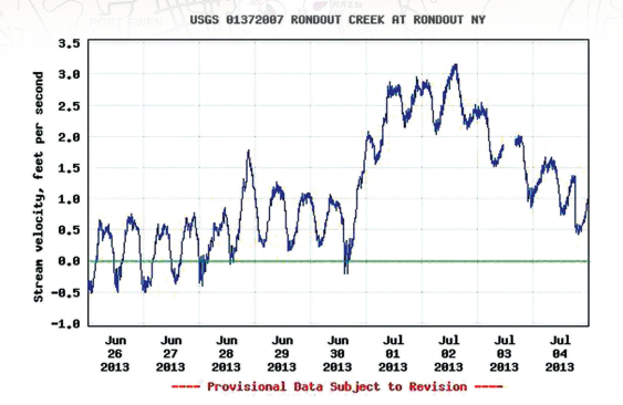
On July 1, 2013, we received an inch of rain following a month of “tropical” wet weather, the wettest June
on record. The flow of Rondout Creek accelerated from its normal fluctuation of about 1⁄3 knot upstream on the rising tide to a 1⁄2 knot on the outgoing to a downstream velocity along the shore of 1.3 knots on the rising tide and 2 knots on the outgoing by July 2. This was a fivefold increase in downstream speed.
Data in the chart on page 58 are from the USGS (U.S. Geological Survey) gauge on the north shore of Rondout Creek just down- stream from the marina. (The USGS measures velocity in feet per second; I have converted to knots.) Midstream currents were much faster. Stream velocity is greatest in midstream near the surface and is slowest along the streambed and banks. The location of the USGS gauge is also somewhat protected by an upstream island.
I do not have a measure of the midstream current at our marina’s outermost docks, but large sections of trees traveled steadily downstream. Mallards did not even try paddling against the current. Islands of foam from the small waterfall three miles to the west raced by. Swirling water gurgled against our pilings and tugged at boats and docks. Water rushed around the nearby green can and red nun, tipping the aids to navigation and hiding their bases.
Still water deceives
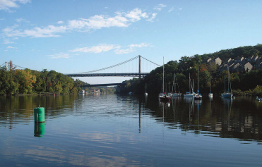
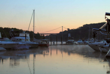
Our marina is supremely protected from wind. The entire 4-mile navigable length of Rondout Creek from its mouth on the Hudson to the remnants of an old Delaware and Hudson Canal lock is a no-wake zone. With little wind effect to disturb the surface and no wakes, the water is typically, deceptively, very calm. The surface stays quite smooth, even when the current runs fast. Boaters unfamiliar with the local indications of current frequently misjudge the speed at which the water is flowing.
Hudson River currents for the same day did not deviate from normal. This is not really surprising when you remember how small Rondout Creek is in comparison to the Hudson. The great volume of the Hudson would rapidly attenuate the fast water flowing from the Rondout.
Untimely reschedule
On July 3, I had boats scheduled to come into the marina for transient dockage for three days. Good. By then, without rain (sun was predicted) the speed of the flow would subside. Then two cruisers telephoned to ask if they could come in a day ahead of schedule. “Sure,” I said, “but be advised, we are experiencing current stronger than normal due to the recent rains.”
Where can I dock them with this current? I worried, wishing they had not asked to come in early. The slips I had planned for their arrival the following day would require them to dock broadside to the current and they would have to make a U-turn, across the flow and then with it, to get there. Too risky this day.
I had spots available that would allow them to come into the dock parallel to the flow, but only for a single night. I would dock them there and then move them when the current subsided. I explained this to them before they left their previous night’s berths. OK. They still wanted to come.
Current? What current?
In midafternoon, both boats came in and docked without problems: bows into the current, angling gradually toward the dock.
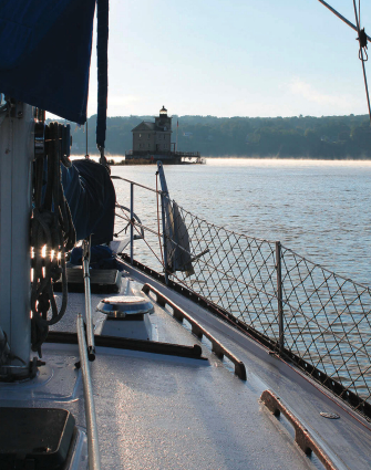
The first skipper to dock commented, “You had us a bit nervous, talking about the current. The only current we noticed was at the mouth of the creek, by the lighthouse.”
I was stunned. “Do you see the logs and foam traveling rapidly downstream?” I asked. “I can’t tell you exactly how fast it’s going, but I believe the flow’s a couple of knots. Do you have a knotmeter?”
No knotmeter. Just GPS.
We docked the second boat a bit farther along the dock without incident. Again, the skipper commented that he did not notice the current.
“No knotmeter?” I asked. “Oh, I have a knotmeter,” he laughed as he ducked into his cabin. He emerged holding a disconnected knotmeter in his hand. “I just use GPS.”
I walked both skippers down the dock to show them the slips I wanted them to move to the following day, with assistance from the marina staff and when the current had subsided some.
“OK. No problem. Sure you don’t want us to move now?”
“Yes, I’m sure.”
I explained the current should drop pretty dramatically without rain and conditions would be more favorable if they moved on the rising tide. I suggested that, when we moved them, they should experiment a bit in the mainstream to get a feel for how the current would affect their boats, rather than making a U-turn around the T-head without a “dry run.”
We did it. We got both boats safely into their slips the following day . . . after about three tries each, even with good piloting and extra dockhands. Safe and secure, both skippers finally agreed, “That would not have happened yesterday!”
The missing link
A knotmeter used in combination with a GPS provides a real-time assessment of current: valuable information for making docking decisions. I’m surprised to learn that many boaters no longer use knotmeters.
But it’s not really about the knotmeter . . . or about the GPS. It’s about weather and current, skipper and boat, instruments and observations . . . sensory and technological connections: look, listen, feel.
And a little local knowledge.
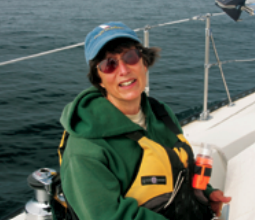
Cheryl Thomas grew up sailing a Wright-built K-boat on Keuka Lake, one of New York’s Finger Lakes. She and her husband now sail a 1979 Hunter 37 cutter — currently on the Hudson River, formerly on the Gulf Coast of Florida.
Thank you to Sailrite Enterprises, Inc., for providing free access to back issues of Good Old Boat through intellectual property rights. Sailrite.com