Viewing vessel traffic with a smartphone app
Issue 118: Jan/Feb 2018
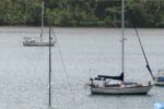
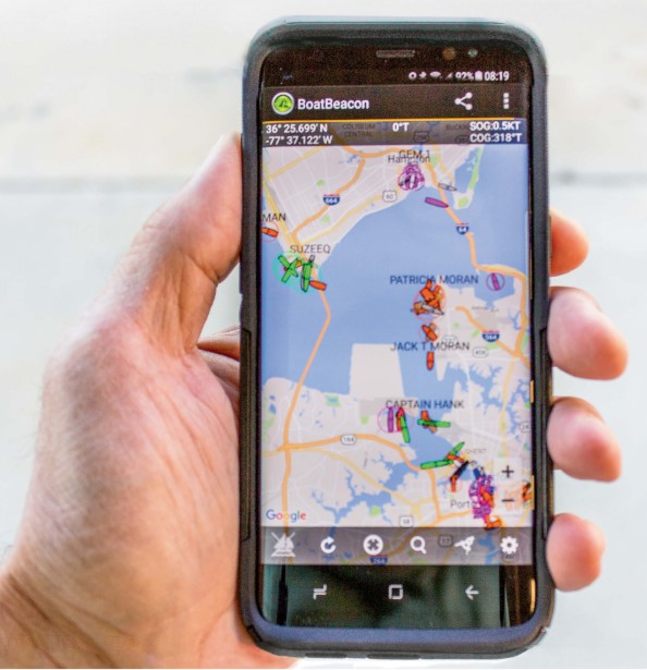
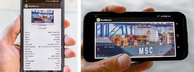
A couple of times a year, I find myself on Virginia’s Hampton Roads, a large natural harbor close to the mouth of Chesapeake Bay. With a large Navy base and several shipping terminals, this body of water is always busy with vessels of all descriptions. I’ve often wondered about what they are, where they’re headed, and what they’re named. I don’t have to wonder anymore. Whether I’m ashore with a view of Hampton Roads or seated at my office desk 100 miles away, I can pull up an app on my phone and see nearly all the traffic, in real time, displayed on a NOAA chart. I can select an individual vessel and see the information it’s broadcasting via AIS, the Automatic Identification System.
AIS is a product of a mandate the US Coast Guard received from Congress, following the 1989 Exxon Valdez disaster, to create a system that shore-based Vessel Traffic Services (VTS) could use to track Alaska-bound oil tankers. Using encoded VHF radio signals, AIS transmitters broadcast vessel information along with real-time speed, heading, and destination. This information can be received and interpreted by AIS receivers. In a relatively short period of time, it has become a hugely successful system and has been adopted worldwide. AIS transceivers are mandated for use by most commercial vessels, and many private motorboats and sailboats carry a transceiver or a receiver.
A mobile internet app takes this technology a step further.
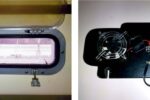
Boat Beacon is an app for GPS-enabled iOS and Android devices that collects AIS-transmitted data from shore-based stations and broadcasts that data (usually with about a 1-second delay) via the internet to app users. Alone, this capability is not remarkable. Several apps do the same thing. But Boat Beacon allows me to broadcast my own position (generated by the GPS function on my phone), which is then broadcast to other Boat Beacon users — I show up on the screen just like a vessel with an AIS transmitter. And if I enter a Maritime Mobile Service Identity (MMSI) number, my position will also show up on other apps that follow AIS traffic, such as Boat Watch and FindShip. However, this transmission is virtual and limited only to these internet-based apps — my position will not be visible on vessel-based AIS receivers.
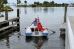
But that does not mean that this function serves no purpose. I envision local sailboat races in which every skipper carries a smartphone running the Boat Beacon app. Not only would skippers be able to see their competitors’ real-time positions, but those on shore could follow the race with a bird’s-eye view. Also, family members going out for a daysail can use Boat Beacon to watch vessel traffic while a spouse back home keeps track of them (so long as they remain in range of a cellular signal).
Boat Beacon transmissions are broadcast only to other internet-based AIS systems. Because most vessels use only VHF-based AIS equipment, Boat Beacon users will not be visible to other traffic. Because of this limitation, and because cellular signals cannot be trusted to reliably send and receive AIS data, Boat Beacon should not be used for navigation or collision avoidance.
I have learned that I need to have supplemental power for my phone when I use this app aboard; using GPS increases power consumption. Also, I usually hug the coast and cruise inland waters where cellular signals are generally strong. If I were to venture farther from shore, Boat Beacon’s utility would disappear.
Several add-on tools are available to enhance the app’s utility. These range from upgrading from Google Maps to NOAA charts to integrating with a FLIR infrared camera to see nearby vessel traffic at night.
Overall, Boat Beacon is a fun and affordable app. I use it to learn more about the vessels I see on the water and as one more tool to supplement my existing navigation and collision-avoidance information.
Resources
Boat Beacon is a product of Pocket Mariner – www.pocketmariner.com
MMSI number
A vessel MMSI number can be obtained for free in the US from the United States Power Squadrons or BoatU.S. Foreign-going vessels must obtain a station license and MMSI from the FCC. Industry Canada issues MMSIs for Canadian vessels.
Jerry Thompson is an information systems professional who works and lives in eastern North Carolina. He learned to sail more than 25 years ago at the Armed Forces Recreation Center, Lake Chiemsee, Germany. North Carolina’s milder winters keep Jerry on the water year-round.
Thank you to Sailrite Enterprises, Inc., for providing free access to back issues of Good Old Boat through intellectual property rights. Sailrite.com