Navigation catches up with science fiction
Issue 66 : May/Jun 2009
A dream is coming true far faster than I ever would have imagined. It’s foggy, and I’m anchored in Gambier Island’s Halkett Bay on the coast of British Columbia in soup so thick I’m unable to even make out the shoreline. For all I can see, I could as easily be on Lake Superior, yet I’m sitting aboard Haiku, marveling at just how unlost I am.
On the navigation table in front of me is the marine equivalent of a device from Douglas Adams’ The Hitchhiker’s Guide to the Galaxy. The little gadget employed in Douglas Adams’ books was a portable device that contained all the knowledge of the universe. Internet users know that this fictional device is fast becoming a reality, and it’s certainly becoming true for boaters.
I’ve booted up Google Earth on the laptop, and it allows me to see a marker on the planet that shows my exact location. Also on the screen are little icons I can click on to view all kinds of information, including the logbook of someone who’s anchored here before. This part of the dream is already a reality.
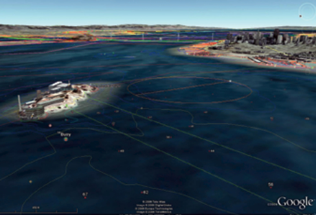
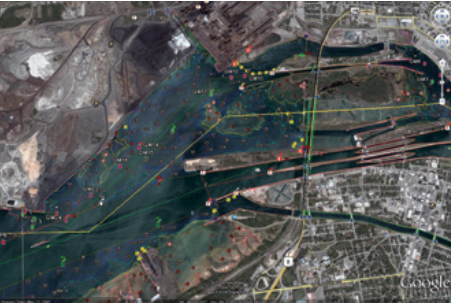
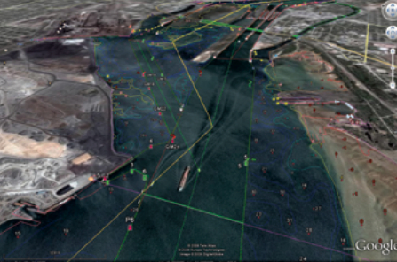
In the morning, before I haul the anchor, I’ll be using an add-on navigation program for planning my day. It works directly with Google Earth to display specific marine information, including underwater obstructions, lighthouses and beacons, channel markers, and much more. With my GPS adding its two cents for tracking, it feels as if I’m cruising with a science-fiction version of navigation.
So far, this part of the dream is true only for limited regions of the globe. Currently, two add-on products are available that combine conventional digital charts with Google Earth as well as adding additional dynamic features, such as weather, wind, and wave heights.
Managed with less
It’s true that I could easily manage with a lot less. For years, I found my way along the coast of British Columbia with paper charts, a couple of compasses, the cruising guide, a tide chart, and a lot of luck. I also had Loran, but since it would occasionally tell me that I was cruising somewhere in the Rockies, I never staked my life on it.
A lot can be said for traditional navigation methods, but there’s also something intriguing about a navigation system that allows you to see exactly where you are on the globe. And that’s where Google Earth comes in. As Google Earth and its add-ons develop, a navigation tool will eventually emerge that will let you see where you’re sailing while also providing all the traditional information of digital and paper charts — and a whole lot more.
Google Earth is available free to anyone with a high-speed Internet connection. It displays the entire globe as a satellite image, lets you move it around as if it were a basketball in your hands, and allows you to zoom in on anything you’re interested in seeing. You can actually view your house or the slip where your boat is docked. You won’t necessarily see your boat, however, because the satellite photo could have been taken at any time from a few days to a few years ago.
You can choose to have borders and place names appear. You can click to view local information, the sites of famous shipwrecks, Joshua Slocum’s route, and any number of other layers of videos, photos, and much more.
If you haven’t previously used Google Earth, you’ll need to go to the website (see Resources, this page) and follow the simple instructions for installing the software. If you’re using an iPhone or an iPod Touch, the download is available either from the iTunes Store or by tapping on the App Store icon and searching for Google Earth.
Not for navigation
By itself, Google Earth is still far from being a marine navigation tool, but it nevertheless provides boaters with much valuable information. It organizes everything in layers that the user can turn on and off at will — layers that include place names, restaurants, historic sites, geographic features, information on marinas, and photos and videos of local attractions in the area being viewed, as well as street-level views of some of the world’s major cities.
Google Earth also allows me to change perspective and swivel from a bird’s-eye view to something more closely approximating a head-on view. That gives me a much more easily understood presentation of my surroundings.
Thousands of boaters have made their logbooks openly available on Google Earth. You can pick up advice on the best restaurant in the port of Kusadasi in Turkey or anchoring tips on your favorite lake in Wisconsin. You can also follow the adventures of those who update their logbooks at sea, complete with photos, videos, hair-raising stories, and hilarious episodes.
Those who post their logbooks out of range of the Internet do so by email over SSB and ham radio from virtually anywhere via a special form letter that automatically plugs text and photos into their online logbook and marks their position on Google Earth.
The easiest way to get a look at this is to go to the Sailblog website (see Resources, below), and select “Track blogs with Google Earth” on the home page. If you’ve already installed the Google Earth software on your computer, you’ll automatically be logged on to Google Earth and the overlay will be installed. Suddenly, Google Earth will be filled with markers all over the planet indicating the positions of various cruisers. Click on one, and you’ll be handed the keys to the logbook, unless the captain has chosen to limit access. For the cruising sailor, this means having a master pilot book for the world, filled with anecdotes, photos, local lore, advice on dealing with local port authorities, and even the occasional horror story. While the logbooks may not yet replace local cruising guides, they do provide up-to-the minute information and tips and they’re well worth a look for their entertainment value alone.
Must be online
A major limitation of Google Earth is that to use it in its entirety, you need to be online. As cell phone companies expand their high-speed Internet service, it’s gradually becoming possible to use Google Earth live for coastal and lake cruising. As well, most marinas now offer wireless Internet access.
Even if you are out of range of an Internet connection, you can still use Google Earth, albeit in limited form. Before you leave on your voyage, simply log on to the Internet and visit the areas you’d like to view when you’re offline. The imagery you’ve viewed will be saved on your computer and ready for you to use later without having to connect up.
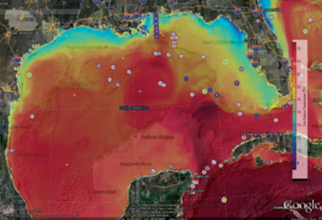
Of course, there are features you won’t have when using Google Earth offline. For example, current weather conditions and forecasts, wave height, wind speeds and directions, and any other information that’s dynamic will not be available.
Google also allows you to switch from earth view to sky view in your location. With Google Sky as your guide you have all the names and positions of the constellations and planets. With it, you can zoom deep into space, seeking other galaxies and gathering the information available in hotspots along the way.
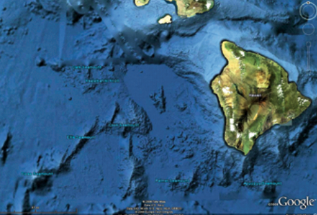
In addition, Google has recently introduced Google Ocean, a combination of global measurement of water depths and special-interest ocean layers. As additional government and research organization information becomes available, Google has announced that it will continue to improve the 3D bottom model just as it currently updates satellite imagery in land areas.
Back on board
The tide is on its way out, and I’m getting ready to weigh anchor and get under way. There’s a 6-knot breeze in Howe Sound to carry me out to the Strait of Georgia, and 4 or 5 more knots for the run up the coast to Secret Cove. With a little luck, I might see an orca or two along the way.
I’m essentially a very traditional navigator, believing strongly that the most important instruments are your eyes, ears, and intuition. Aside from those elementals, though, navigation is continually evolving, and that change is only for the good. From the astrolabe to the sextant, Loran to GPS, and paper charts to digital, the tools of navigation have changed their form regularly and dramatically.
I suspect that nothing has contributed more to the safety of boaters than the increasing accuracy, reliability, and thoroughness of modern navigation systems. With the advent of Google Earth and its enhancements, marine navigation is about to take a leap forward and, with it, safer boating will move forward too.
Alex Morton has had a career as a high-tech executive and has sailed the coast of British Columbia for years on his 27-foot Ericson sloop, Haiku. He writes regularly for magazines, and is working on his latest book, Somewhere Else. He and his wife split their time between Lions Bay, British Columbia, and the Greek island of Ikaria. Read Alex’s sailing “Reflections” pieces at http://www.sailblogs.com/member/voyageswithrosie
Thank you to Sailrite Enterprises, Inc., for providing free access to back issues of Good Old Boat through intellectual property rights. Sailrite.com