Using an EPIRB, they initiate a costly communication but avoid an even more costly search later
Issue 16 : Jan/Feb 2001
It was 3 a.m. Everything bad at sea happens at this hour. Minutes later, when we seemed to have no recourse, I pushed the EPIRB switch to the “on” position, then sat back and waited for the U.S. Coast Guard. What followed was both expected and surprising.
This happened on our sail from Monterey, Calif., to Honolulu, Hawaii, which was not quite typical — but in more than 160,000 miles of sailing together, Carolyn and I do not recall too many typical conditions for ocean crossings. The winds were light for the first 1,000 miles. For the second 1,000 miles, winter storms battering the California coast wrapped their tails around us, pulsing large seas south and southwestward. Winds were a tolerable 35 to 45 knots. Following breaking waves piling up higher than 30 feet started our problem.
The ride was surprisingly comfortable, even sledding down waves at 12 to 13 knots with the autopilot doing the dirty work. The two of us were crewing a nearly new Tayana 52 on a delivery to Honolulu. For reasons I could not understand, the windvane steering lost the ability to turn the rudder enough to meet the existing conditions, so we engaged the autopilot. I was puzzled. These were the conditions where the windvane should work best. I pointed out later to Carolyn that the autopilot was driving the steering wheel excessively, but this I attributed to the effects of two towering wave systems colliding, causing a confusing sea surface. Further, the rudder angle indicator gave strange positions for the rudder that I did not understand. I rationalized this as a faulty instrument reading. Occasionally the autopilot would kick off with a “rudder” warning. I kept tuning down the sense setting, and the resetting always got it back.
Channel fever
Our destination was less than 500 miles away. Channel fever crept into our attitude. Liberty in Honolulu was not quite three days away. Suddenly and unexpectedly the boat slewed around and jibed. The alarm sounded on the autopilot; it tripped off the line again. I rushed to the cockpit to regain control of the boat and head it back down swells and downwind. We lay beam-on to wind and sea — a vulnerable position for rollover. I spun the wheel to starboard. The bow remained pointing in the same direction. No steering. We rapidly reefed sails to slow the boat and settled down to a comfortable 3 knots on a heading toward Tahiti, the only way it would point.
Lack of sleep muddled our minds. Obviously the rudder was not working. Broken shaft? Cable? A quick inspection showed the cables to be tight and connected. It was not possible to view the rudder — but it had to be there. We set up the emergency tiller. Because of obstructions to the tiller bar’s path, it was only usable through a few degrees. It took both of us pushing and pulling on the tiller bar to move the rudder back to the centerline from where we discovered it jammed hard over — well beyond its normal 35-degree maximum deflection. This confirmed we still had the rudder, and its shaft was not broken. This action eased the heading off a little. However the emergency tiller was not usable in these conditions. Next I rigged the Monitor wind steering vane to act as an emergency rudder. Our heading was about 150 degrees. Honolulu bore 260. The Monitor’s small water blade steered the 20-ton boat around only 20 degrees to a heading of 170. Not enough. On this course, we would still miss the island chain at the south end of Hawaii by at least 200 miles.
Float plan
We always travel under a float plan filed with our daughter, Pam. We provide her with the vessel’s information plus the planned navigation route with arrival times. She calls the Coast Guard if we are overdue. At our present rate we were going to be very overdue, anywhere. We usually travel with a single-sideband transceiver. This boat had none. I did, however, slip aboard our Alden Satfind II 406 MHz EPIRB. The weather, after we’d lost steering, was forecast to remain the same except with winds increasing to 50 to 60 knots along the windward coasts as we approached the Hawaiian Islands. We had more than a month’s food and water aboard without rationing. We could expect winds from the east-northeast to prevail, leading us to nowhere in the north central Pacific unless we could rig some sort of steering.
It was time to let someone know of our plight while we worked out the problem. If we missed our ETA with no word to anyone, the Coast Guard would be saddled with an improbable search area, extending from Monterey to Honolulu. Since we were south of the shipping lanes, we could not expect any VHF contacts. Only the EPIRB remained.
I turned on the switch and set the EPIRB on the cockpit sole. It lay there sliding around, antenna canted at an angle of about 30 degrees to the horizon, strobe light flashing, my only assurance that it was working. I went below to wait for whatever this mysterious yellow plastic package did and took a nap. I’d had three hours of sleep in the past 30 hours.
Tied vertically
Four hours later: nothing. Maybe, I worried, lying as it was at an angle in the cockpit did not allow the antenna to broadcast its twin signals in the right direction. So, I tied the EPIRB to the dodger stanchion in a vertical position. The strobe still flashed as my only assurance that the transmitters were broadcasting — the continuous 121.5 MHz to alert overflying aircraft and the coded microburst signals every 50 seconds on 406.025 MHz to the COSPAS-SARSAT search and rescue and GEOS weather satellite systems.
Clouds obscured sunrise, but with the early light came a report from the long silent speaker on our VHF radio: “Moonshadow Three, this is Coast Guard Rescue One Seven One Four, over.”
An HC-130 Hercules from Coast Guard Air Station, Barber’s Point, reported it was about 20 minutes out heading for our position. This first contact with the Coast Guard occurred four and a half hours from the time I hit the switch on the EPIRB. It worked!
However, the aircraft did not receive the VHF 121.5 signal from the EPIRB to home in to our position, hampering their ability to fly directly to us. (This transmitter was later found to be defective when returned to the manufacturer. Only the 406 transmitter was working. The aircraft crew verified the 406 transmission from the flight deck but this signal cannot be homed in on — a justification for the different category dual transmitters on the EPIRB.) The HC-130’s crew located us by homing in on transmissions from our onboard and handheld VHFs. The sea state and visibility at the time prevented the foot sailboat among the rushing mares until it was less than a mile away. We were able to see the airplane at five miles out.
Daughter alerted
We briefed the Coast Guard crew of our situation and needs. The Coast Guard informed our daughter that we were OK. She had been awake much of the night, alerted by a telephone call 10 minutes after I turned on the switch. The Coast Guard’s Rescue Control Center (RCC) in Seattle called her and reported that a beacon with our registration was picked up and reported as an “unlocated alert.” All the information the Coast Guard had at the initial call was that our beacon was transmitting from an unknown position.
I switched the EPIRB on at approximately 12:32 UCT (all times here are Coordinated Universal Time). A receiver in the geostationary GEOS weather satellite, G10, detected our 406 signal at 12:33. It, being stationary in space, cannot determine position using Doppler-shift processing, since it has no motion relative to the earth. The United States Mission Control Center (USMCC) in Suitland, Md., one of 15 around the world, received the signal information because in the transmission from our EPIRB was a code indicating it was U.S.-registered. At 12:37, USMCC established a “site,” passing the EPIRB personal registration data information from their files on to the Thirteenth U.S. Coast Guard District, the RCC located nearest our address.
Five minutes had elapsed.
Position undetermined
Up to this point, the system was working perfectly. The satellite system was not yet able to determine our position, but controllers knew who we were and that we were likely seeking help. (However, NOAA reports approximately nine false alarms on the 406 frequency for every actual emergency and more than 1,000 erroneous signals on 121.5 for each legitimate call for aid.)
Serendipity moved events forward despite a failure on my part. Seattle Coast Guard RCC called our telephone number at 12:39, the one listed on the registered form (the one I filled out when I purchased the unit nearly two years before). This call was to verify the signal and eliminate the possibility of a false alarm. No answer. We were 2,500 miles away from our home telephone. They next tried our fax number. At the time of registering the EPIRB, our daughter — the “emergency contact ashore for information on vessel itinerary” — lived in our home. She moved later. I did not change the form. I had, however, left a message on our answering machine announcing her new phone number. The RCC controller picked up on this and two minutes later was informing her of our EPIRB signal and asking for float plan data.
I was bewildered at the first contact by the overflying Coast Guard HC-130 that they had all the information they needed, including the names and number of people on board, not aware that our daughter was already a significant element in the rescue effort.
Two positions
The first pass over our position of the polar-orbiting COSPAS-SARSAT satellite number S6 at 12:45 — 13 minutes after my turning on the switch — determined two possible “solutions” for the location of our boat using Doppler effect. There are seven satellites, three Russian (C4, C6, C8) and four U.S. (S3, S4, S6, S7), flying 620 miles above the Earth in a polar orbit with at least six actively scanning a circle of Earth about 2,500 miles in diameter. The average waiting time for a pass at mid-latitudes is 30 to 45 minutes — longer at the equator. This data from us to S6 was stored aboard then dumped to the nearest ground receiver station (called Local User Terminals, LUTs) it passed. This happened, in our case, to be located at Wahiawa, Hawaii, which forwarded it to the Suitland, Md., USMCC. There are 30 LUTs worldwide, seven serving the U.S. from Guam and Alaska to Maryland. This data was forwarded by USMCC to CCGD14 RCC Honolulu and CCGD 13 Seattle at 12:50.
Satellite S6 passed two possible locations for our 406 signal 915 miles apart. In this instance, Solution B was exactly on our position reported by NOAA at 21.795 degrees north latitude and 150.874 degrees west longitude, while Solution A was 18.164 degrees north latitude and 135.084 west longitude. It was the Coast Guard Rescue Center controller’s task to determine which was our most probable location. Here is where our float plan paid off. Pam provided the controller with our preplanned navigation data. This vital clue ruled out our being at the satellite’s Solution A.
Correct position
A pass by the next satellite would determine the correct position, but that could be as much as 50 minutes later. With the information they now had, controllers could concentrate mustering search and rescue forces on Solution B still yet not knowing the extent of our distress and what might be required.
Nearly 30 minutes had passed from the time I turned on the switch.
The Honolulu RCC controllers went to the computed Automated Mutual Assistance Vessel Rescue system (AMVER) determining the locations of all registered vessels within our vicinity. One Japanese freighter was located nearby and directed to proceed to our position for possible assistance. The Coast Guard Air Station at Barber’s Point, Hawaii, was alerted to prepare to launch an HC-130 to fly directly to the fix given by the satellite. The EPIRB did its job.
The potential failures to the system were of my making. I registered the EPIRB but failed to make changes as my contact situation changed. The message on our answering machine bailed us out. Alert RCC watch standers in Seattle picked up on it and covered my oversight.
Two years too long
Approximately every two years, NOAA, seeking updating information, sends out a 406 EPIRB registration form to registered owners. I learned two years is too long to wait to notify NOAA if the important contacts have changed. Our EPIRB is now registered with home and work numbers for more than one contact. On future trips, as practiced in the past, all contacts will continue to have our float plans.
Recent improvements designed to accelerate information on the location of the signaling EPIRBs are now in service. Called location protocol by NOAA, new model EPIRBs available on the market today can transmit GPS, Loran, or Russian GLOSNOSS fixes. Had we had this, our first contact by the GEOS satellite would have targeted our position. Theoretically, the moment the EPIRB sends its first clear burst to either a GEOS or COSPAS-SARSAT satellite, a fixed site is generated by USMCC. Immediately the data on location for a rescue response is passed to Coast Guard RCCs. In critical situations, this can save several minutes to nearly an hour or more.
After passing our information to the HC-130, and relieved of a ton of anxieties for the distress we were putting others through, we could now attack the problem and figure out how to sail on safely. Somehow, we had to get the boat over to the other tack. A few hours later, after some rest, I sat at the wheel thinking, rocking the dead wheel back and forth. Then I spun the wheel all the way over in frustration. Very slowly, the bow started around. I allowed it to jibe over onto a heading for the islands and it held. Somehow, we had some steering.
Missing key
I squeezed into the lazarette and watched as Carolyn turned the wheel. The quadrant moved with the wheel, but the rudder shaft did not, except for a slight amount as the quadrant neared the stops. A quick inspection revealed that the key was missing from the slot bonding the two together. It had never been installed at the factory. We had sailed this boat for 13,000 miles and a sistership on a 2,000-mile delivery from the Philippines to Singapore, also with the essential key missing. The action of the heavy seas finally overcame the friction bond, and we lost steering.
The autopilot actuating ram was connected to the quadrant, not to a separate tiller. This is why I saw “stop to stop” wheel movement for what should have been small changes of rudder. The rudder indicator was correct; it showed the position of the quadrant, not the rudder. It was also why the windvane could not control the boat through the steering wheel. Out came the tools. Temporary repairs got our steering back. Hilo, Hawaii, was our nearest port, so we headed there as fast as possible to beat the forecast winds.
Using the remarkable COSPAS-SARSAT search and rescue satellite system solved the biggest part of our problem: communication. We could tackle the emergency at hand with the assurance that someone knew where we were and what our situation was. But it is still only a tool. It took the intelligent action by alert Coast Guard personnel to overcome human flaws in the system, demonstrated by this case. Through its use, we were able to overcome our difficulties and sail comfortably into a safe harbor.
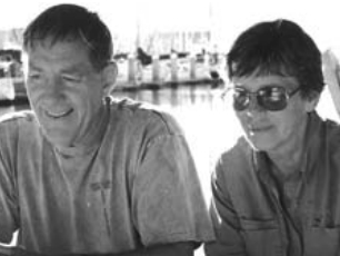
Tom and Carolyn Beard have been boating together as a team for more than 40 years, sailing more than 160,000 miles. Tom writes in his spare time and has published a book: Wonderful Flying Machines, Naval Institute Press. They sail a Baba 30.
Thank you to Sailrite Enterprises, Inc., for providing free access to back issues of Good Old Boat through intellectual property rights. Sailrite.com