Radar takes the sting out of navigating in fog
Issue 38 : Sept/Oct 2004
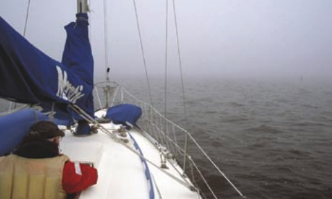
We’d been cruising the coast of Nova Scotia for a week but had yet to see it. Our charts said it was out there to the left somewhere, but the infamous fog was breaking records with its persistence.
“This is so unusual,” the locals told us. “It’s never lasted this long.”
“Uh-huh,” we thought. “Likely story.”
Plowing through clouds that would ground a jetliner, we could only shake our heads at Environment Canada’s less-than-helpful forecasts. Every half-hour they dutifully announced that visibility would be “fair in rain and poor in fog.”
What an amazing grasp of the obvious.
It’s no wonder fog causes such difficulty for the mariner. One classic weather text (William J. Kotsch’s Weather for the Mariner) describes it as “a great swarm-like assemblage in the surface air of hundreds of thousands of water droplets so minute that it would take seven billion of them to fill a teaspoon.”
Seven billion. No wonder it’s opaque.
Fog comes in a number of flavors . . . advection, inversion, radiation, expansion . . . I never can keep them straight, nor do I care to. Fog is fog, and it all looks the same to me. There could be 20 different types, but it all boils down to one basic problem: when the clouds close in around you, you might as well be blindfolded.
When we planned our passage to Maine and beyond, we knew to expect entire days of poor visibility, and we prepared for it. Minimalism is fine; plenty of cruisers sail far and wide without lots of bells and whistles. But we love the capabilities that modern gadgets add. After all, celestial navigation is useless if you can’t see the sun or stars. A dead-reckoning plot won’t tell you what’s out there when your horizon is limited to the end of your bowsprit.
Total refit
Our 1980 Morgan 46 was built for the charter trade. In her previous life, she had no radar nor any of the whiz-bang gizmos for sale in chandleries today. A total refit in 2001, however, brought her into the 21st century. She now carries a Raytheon Pathfi nder SL70 radar with 24-mile range. We mounted a Firdell Blipper radar refl ector and a Davis Echomaster to increase our odds of being seen by other vessels’ radars. There is a Garmin 128 GPS mounted at the navigation station and two handhelds as backups.
While not necessary, but defi nitely nice to have, the upgrade also included a computer loaded with electronic charts and Nobeltec’s Visual Navigation Suite. Linked to the GPS and navigation instruments, this generic laptop is the perfect poor-man’s chart plotter.
The digital charts add a measure of confidence that we really are where we think we are, but for us they’re merely a backup. Should the computer ever crash, we’re hoping we won’t, because we rely first and foremost on good old-fashioned paper charts. While not nearly as much fun as watching the little green boat move across the full-color screen on our laptop, plotting our lat-lon with a stubby pencil keeps us focused.
With radar, it’s a different story. For anyone who plans to sail in fog-prone areas, radar is no mere backup, it’s downright indispensable . . . invaluable. We wouldn’t leave port without it.
Our screen is mounted on the binnacle visible to the helmsman. Having sailed boats where the radar display is belowdecks and sailing now where I can instantly react to what I see, I’d vote for the binnacle configuration in a heartbeat. The instant feedback is critical when tracking an object headed our way.
Enter waypoints
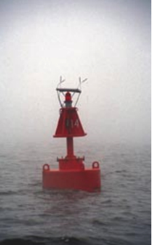
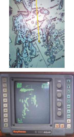
Before getting underway in any weather, we plot our day’s track on paper charts, then enter the waypoints in the GPS. Following this planned route gives us confidence that if we stay on track, we’ll always be in deep water, free of obstacles. Little things like buoys, rocks, ledges, and lighthouses can ruin your day if you get lost in the fog. Knowing where we are on our route, we can now use that information to interpret our radar display.
For the uninitiated, the first glance at a radar screen looks like a Rorschach test gone wild. Depending on how the unit’s tuned, the inky blots appear to blend together with no discernable pattern (see illustration on Page 49). With a little training and experience, however, the masses take on meaning. Shapeless shadows now mirror the contours of land on the chart. Small blips and larger blobs are suddenly significant.
Attitude is everything, and navigating by radar can actually be fun if you approach it like a game. You are at the center of the board, like the bullseye in a target. The object is to keep anything that appears on the screen from reaching the bullseye.
Relative motion plays an important role in the radar game. If you are sitting still and an object on the screen is moving toward you, it’s obviously underway. If you are making way, however, all objects on the screen will appear to move, even if they’re stationary. The challenge, then, is to figure out what each mark represents and how it is moving in relation to you.
Easy to track
This can be quite simple if the screen is blank, as it is when you’re far from land and there are no navigation aids within the set range. A single contact appearing on the screen is instantly noticeable and easy to track. Mark the position of a new contact on the screen when you first notice it. Note the time. Mark the position again a minute or two later. Using a soft plastic straightedge, mentally draw a line between the marks. The spot where that imaginary straight line goes past you in the center of screen is the CPA, or Closest Point of Approach. Our personal comfort zone dictates that to sail safely in fog, the CPA for a small vessel should be no less than 1⁄2 mile. The big ships shouldn’t come within a mile. If we’re uncertain of the vessel’s size, we err on the side of caution.
With this in mind, adjust the range rings on the radar so the inner ring represents your “safety zone.” If that imaginary line in front of the blip is going to cross into your zone, prepare to maneuver for avoidance. A 30- degree course alteration away from your present course may be enough to avoid a close CPA. Small course changes are hard for the other boat to detect, and their effect on the CPA is harder for you to see. After you alter course, plot two more points and check the new CPA.
In general you use course changes as the Rules of the Road suggest for situations where there is good visibility. If the contact is steaming right down your course line on your bow, you are expected to turn away to starboard as you would if there was visibility. (Quoting from the Coast Guard Auxiliary Boating Skills and Seamanship manual: “There is a special provision in the (COLREG) rules for a vessel which detects the presence of another vessel by radar alone. The law requires this vessel to take action in ample time if a change of course becomes necessary. If the other vessel is forward of the beam (and not being overtaken), the change of course should not be to port. If the other vessel is abeam or abaft the beam, the change of course should not be toward the other vessel.” In practice, this first provision is a tough one. It means that if a vessel is forward of your port beam you would turn to starboard to avoid a collision. This special provision is sometimes debated. We do not invite you to break this rule. If this editor thought risk of collision existed in such a situation, he would turn to starboard onto a reciprocal course. If this editor simply wished to widen the CPA where risk of collision did not exist [yet] he would maneuver to take the stern of the other vessel, never crossing its bow. –Ed.)
Now you can see that the blip will pass well out of range. Congratulations. You just won that round. Once the contact is past the new CPA, you can come back to your original course, keeping your eye on the contact to make sure no more adjustments are necessary.
If your chart is cluttered with lots of things that go bump in the night, use your current position to identify every known contact on the radar screen. Working your way around the circle, pick out each one. Count the range rings to figure out its distance from you. Say there’s a blip just outside the 2-mile range ring at the 1 o’clock position on the screen. You look at your plotted position on your chart and there, 2 miles ahead, just to the right of your track is a red nun. Bingo. You’ve identified that blip.
In reverse
This process works equally well in reverse. Look at the chart and pick out all charted objects within the range set on your radar. (In busy coastal waters, a good range is 3 to 6 miles). Your chart shows a green can 1 mile off your port beam. If your radar rings are set at 1⁄2 mile, look at your screen. Sure enough, there on the second ring at 270 degrees relative to you at the center is the return from the can. One less thing to worry about.
If you have identified all the contacts on your radar as charted objects, you can relax until the next round of play. Those blips pose no threat as long as you stay on course. Any unidentified blobs, however, represent things that weren’t there when the cartographer printed the chart.
Generally, the larger the return, the larger the contact. Large ships’ blips are distinctive, often rectangular, but the smaller returns can be more challenging. What appears to be a small boat can turn out to be a lobster pot buoy or even whitecaps on a blustery day. Our radar is so sensitive that we’ve tracked fast-moving objects that turned out to be seagulls.
It doesn’t take long to figure out which returns on your display demand your attention. As in the previous example where there was only one contact, any target that is going to pass within your safety zone, either because you approached it or it approached you, needs to be avoided. A simple course change will magically move the entire picture around you.
If there’s any question about your safety in relation to one or more vessels in your vicinity, your VHF radio can play an important role. To notify a single vessel of your presence, try to raise him on Channel 16. You can state his location with a lat-lon or by referring to a known landmark, like this: “Vessel 1 mile east of Sandy Point in Broad Bay, this is the sailing vessel Liberty two miles off your port beam.”
Securité call
Once he answers, switch to an agreed-upon working channel and discuss how you will pass each other. If the vessel fails to respond to your call, or there are a number of vessels in your vicinity, you can issue a general “Securité” call. This lets everyone around you know you are there. If they think they’re going to pass nearby, they will usually call to discuss the situation.
The big ships and smaller charter boats do this in fog all the time, so I felt like one of the professionals one foggy morning when I announced into the handset, “Securité, Securité, Securité, this is the sailing vessel Liberty, departing the Lunenburg Harbor anchorage on a course of one-one-zero, speed 5 knots, en route Battery Point. Liberty standing by on Channel one-six for all concerned traffic.” No one answered my call, but after hearing a vessel at a nearby wharf sound one long blast to announce his imminent departure, at least I felt more secure.
When we first arrived in Maine, we were relative novices at the fog game, but after only a few hours of navigating through the soup we began to trust our system. In the past, before we installed our radar, a foggy day meant staying at the pier. Now we simply fire that baby up and head to sea.
Without the visual distractions of a clear day, I entertain myself trying to picture what’s really out there. Is that medium-sized dot a sleek motor yacht headed for the big city, complete with private chef? Is that smaller one a rusty old fishing trawler surrounded by squawking gulls? This is fun for a while, but soon the mental images lose their importance. Big or small, the goal is to avoid contact with the contacts.
Large blob
So it was with no great concern that I glanced over my husband’s shoulder at a rather large blob on the radar. We were approaching Halifax Harbor and traffic was picking up.
“That must be a big guy,” I said as I stretched lazily, preparing to take over the wheel.
“I’ve been tracking him for the past hour,” Ty said. “He was moving for a while and crossed our bow at 2 miles, but now he seems to have stopped. I’ll bet he’s waiting for a pilot.”
We had intersected the shipping lanes and now changed course 90 degrees to parallel the channel. As we turned, the large blip slowly moved around the screen.
“Yeah, he’s just sitting there,” I confirmed by studying the relative motion.
We continued toward the harbor, and I monitored our progress in relation to the blob. It appeared to move down our starboard side, but that was only because we were pulling away from it. Another contact off our bow drew my attention when it ghosted down our port side unseen, half a mile away. Passing distances were closer than we would have liked in this busy harbor, and we glanced at each other warily. Until then, the only sound in this strangely silent world was the mournful moan of a fixed foghorn well west of us. Now the passing vessel’s engines throbbed loudly through the mist, their rumble greatly amplified in the thick air.
With a number of new contacts on the screen, Ty stepped forward to sound our fog signal. One prolonged and two short blasts announced to anyone within earshot that we were a sailing vessel making way.
Roar from aft
Suddenly, a wall-shaking “WHOMMMMMMM” blared up our transom like a roaring locomotive. Like cartoon characters with perfectly round eyes, our heads snapped around. Seeing nothing through the blasted whiteness, our eyes immediately turned to the radar screen. The attention-grabbing horn sounded as if it were mere meters away, but there was nothing astern of us save the contact we’d been tracking for over an hour.
“Yep, he’s a big guy, all right!” I gulped, triple-checking that the large blip was still a mile away and growing no closer.
Ten minutes later we emerged from the fog as if stepping through a curtain. Like a movie suddenly playing on a blank screen, Halifax Harbor lay before us, sparkling under a clear, blue sky. I turned the wheel over to Ty and busied myself preparing for our arrival.
“Look at that,” Ty said, interrupting my tidying.
Thinking he was pointing at something on the skyline, I casually peered around the dodger.
“Oh my God!” I exclaimed, as a container ship the length of 10 football fields passed us to starboard.
We had crossed his bow a mile and a half ahead, but I hadn’t seen him on the radar before turning over the wheel. Glancing at the behemoth, I studied the screen to figure out how he had surprised me. He had been berthed at the wharf around a spit of land ahead of us. His large radar return had blended in with the ill-defined land mass before he made the turn for open water. Ty had picked up his track as the ship left the pier. Clear of the narrow neck, it now reflected a well-defined blob in motion.
“That’s what we’ve been out there with,” I said. I couldn’t help but shudder, even though we’d been in no danger. I noted that this ship’s return was the same size and shape as the vessel that had blasted its horn earlier and thought that sometimes it’s better not to be able to see!
We had successfully maneuvered around numerous such contacts because we trusted our equipment and our skills. Watching this big ship disappear behind the curtain from which we’d just emerged, my confidence returned. Had the fog extended all the way into the harbor, I knew we would have seen him on the screen just as clearly as we had seen him minutes before with the naked eye.
Navigating in fog is neither relaxing nor pleasant, but it doesn’t have to be something to fear. With the proper equipment and the ability to interpret what that equipment is saying, any sailor can safely sail through the maddening mist.
Thank you to Sailrite Enterprises, Inc., for providing free access to back issues of Good Old Boat through intellectual property rights. Sailrite.com