A way to keep charts handy to the helm
Issue 54 : May/Jun 2007
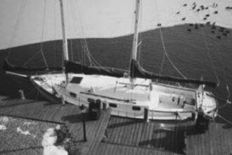
Beth and I sail our Ericson 31 in Puget Sound and north into the Canadian Gulf Islands and the shores of Vancouver Island. Even though we cross the Strait of Juan de Fuca and the Strait of Georgia, we’re seldom out of sight of land, sailing close to shore, keeping clear of rocks and kelp beds that swirl in swift currents and narrow channels. Our navigation consists of continuous piloting — not only for keeping Kuma out of harm’s way but also to relate everything on our charts to what we see in the real world — to learn more and simply for the fun of it.
The standard Cruising 31 has a navigation table that folds down across the end of the quarter berth so it can be used from the starboard settee. This works well but, because of the way we cruise, the nav station below is a solution for which we have no problem. We’ve removed the table and the quarter berth cushion, providing additional and more convenient storage for dinghy oars, crab traps, foul-weather gear and such, while giving us more wiggle room for getting at the engine and cockpit-drain seacocks.
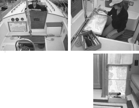
The heart of our piloting system is a 16-inch by 27-inch piece of well-varnished marine plywood. The board takes NOAA Nautical Charts 18423 and 18445 and the Canadian Small-craft Chart 3310. A piano-hinged piece of acrylic protects the charts and allows use of a grease pencil that is easily erased with a cloth.
The board fits neatly against the Cruising 31’s main bulk- head, just to port (the large side) of the off-center companionway. It’s held in place against the bulkhead by chocks on the bridgedeck and a turn-button at the top, just under the knotmeter and depth sounder. We frequently take it down for a longer, more convenient, look or to do course work.
I’ve built an extension to the bridgedeck — a sort of raised cockpit sole that provides us with a little more room for plotting with the addition of a place underneath for a handy bucket and an instrument box that holds, among other things, the log book and tide tables, cruising guides, hand-bearing compass, dividers, parallel rules, pencils, masking tape, and a tiny digital camera. Before sunset we take this box and board below where they’re handy in planning the next day’s cruise.
I am frequently reminded that this is an unconscionably archaic way of knowing where we are, but it’s an important part of the joys of cruising for us . . . right up there with other tedious pursuits such as bird watching and building a fire in the Dickinson during damp, chilly, and gray mornings.
Thank you to Sailrite Enterprises, Inc., for providing free access to back issues of Good Old Boat through intellectual property rights. Sailrite.com