Issue 136: Jan/Feb 2021
Nav on the Table

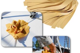
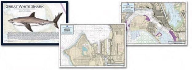
The first thing I noticed when I received these nautical chart placemats was the bold warning that they not be used for navigation. Ha! Tell that to my 9-year-old grandson who began using his placemat to plan his dream voyages. Eating is one of the few times my grandchildren stay still, and it was a joy to see their attention drawn to these placemats and to hear their questions about what the various chart symbols meant and why there were numbers printed everywhere. The mats aren’t only educational, they’re durable—we’ve used and washed them for over six months and the lamination is holding up just fine. Best yet, they sparked a curiosity that led us to dig out real paper charts to share with the grandkids. And we didn’t just test the chart placemats, but some that feature various species of marine wildlife, including an illustration and description. The great white shark was popular aboard Seabreeze, our 1990 MacGregor 26D.
The company publishes dozens of different large-scale charts covering harbors and areas of interest from Alaska to Cuba to Southern California to Cape Cod. The wildlife mats feature mostly fish, from the albacore to the yellowtail. The mats are sized 12 x 18 inches. For more information: prostarpublications.com —Carol Severson, Good Old Boat contributor
Nav in the Pocket
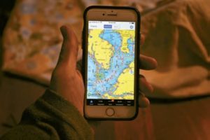
During a recent cruise of Southwest Florida, I had occasion to use the iNavX charting/navigation app on my iPhone 8. While the app can be downloaded onto an iPad or Android tablet, and a more sophisticated version can be installed on a Mac laptop, the beauty of running the app on the iPhone is that I was able to easily keep it with me in the cockpit—literally in my pocket—without risking damage. iNavX has been around for quite a few years but was still new to me. During this short Florida cruise, I didn’t have occasion to use all of its features, but I did use it for basic navigation, watching our position in relation to depths (always a concern in Florida waters), speed over ground, etc.
iNavX can display raster and vector charts, and your position is shown on the displayed chart using data from your phone’s built-in GPS. While an internet connection is necessary to download chart data, once loaded onto a device, map data can then be accessed offline. Waypoints are easy to input, and iNavX can display off-course and ETA data. Additionally, the app can connect via NMEA 2000 with other GPS devices on board, as well as to instruments such as depth, wind, engine, and batteries.
You can purchase and download the basic app from the iTunes App Store (iOS) or the Google Play Store (Android). Once the app is loaded, you can purchase and load chart data for a particular area separately. Chart data subscription plans are also available. The costs are substantially lower than the cost of paper charts covering a comparable area. Apps that integrate with iNavX are also available from the same software developer; these include AIS, tides and currents, and GRIB weather apps. For more information: inavx.com —Dan Spurr, Good Old Boat Boat Review Editor
Thank you to Sailrite Enterprises, Inc., for providing free access to back issues of Good Old Boat through intellectual property rights. Sailrite.com