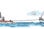
A voyage to a new home in North Carolina offers something fresh around every bend.
Issue 139: July/Aug 2021
I’ve spent 40-plus years sailing—mostly singlehanding—New Jersey’s Raritan Bay. It’s been great; the Bay offers semi-protected ocean sailing and makes an excellent jumping off point for storied places written up in every sailing magazine: Block Island, Newport, Cuttyhunk, Martha’s Vineyard, New York Harbor, Long Island Sound, and Nantucket.
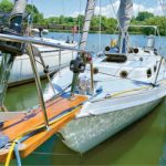
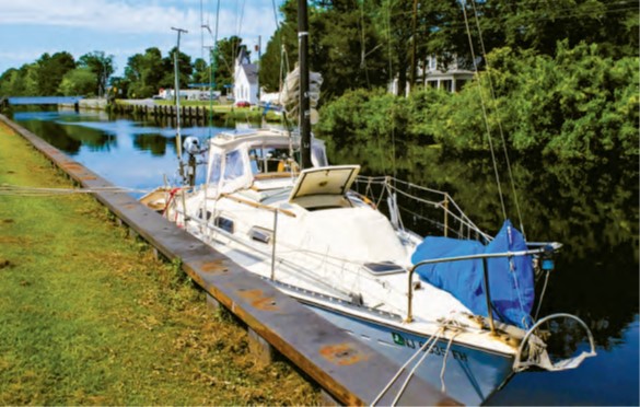
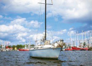
But the time had come to make a long-planned move south, to coastal North Carolina. And because I couldn’t imagine leaving her behind, my longtime sailing partner, Pelorus, a 1980 Paceship 26, was moving too.
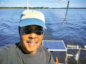
Once I decided that I would solo-sail Pelorus south on her own keel, I started planning. I was pushing 70, and I was looking forward to this, a chance to explore new places, meet new people, and enjoy new experiences, all from aboard the same good old boat.
The first step was readying Pelorus. I spent a week at the boatyard thoroughly inspecting, recommissioning, and repainting the bottom following a hard New Jersey winter. Before launching, I took time to restore some brightwork and check all the systems. Then I topped off the propane and fuel tanks, and Pelorus was ready to go.
I decided the trip would be made at a cruising pace, not a delivery pace. I had no need to push things, maybe aim to make roughly 50 miles a day, sleeping soundly each night on the hook. I would build in time for bad-weather days and the unexpected so that I was never rushed.
So it was that on a clear May morning, Pelorus, stocked with food, water, ice, and a spare jerry can full of diesel, motored out of Morgan Creek, the westernmost part of Raritan Bay, headed for New Bern, North Carolina. As we rounded Sandy Hook (keeping well off the False Hook) the wind picked up enough to carry sail.
We made a pleasant 45 miles or so, and I anchored that first night just inside Manasquan Inlet near Point Pleasant. I had been a little nervous about where exactly I would anchor in what is otherwise a busy inlet, but I found a good out-of-the way spot in 8 feet of water not far from the channel where I spent a quiet night.
Heading out the next day, I realized that I’d never traveled any further south by boat, and that everything hereafter would be new to me. I was committed and there was no going back; I was escaping forward.
Any voyage along the New Jersey coast is in the Atlantic Ocean, for me best done at least a mile or so offshore—what sailors call “one foot on the beach”—in about 60 feet of water. Once I reached the mouth of Delaware Bay, I would be able to sail into more protected waters and continue the trip on the Intracoastal Waterway (ICW). I figured I could reach Delaware Bay in three days after leaving Morgan Creek, but the Clerk of the Weather had other plans.
With the NOAA forecast calling for a two-day nor’easter, I tucked into Atlantic City before it started. A local cruising guide led me to a protected, hidden anchorage where I could wait out the blow. Inside the breakwater, I motored past bankrupt Trump casinos and turned into an inlet not much wider than my boat that led through a marsh before opening to a broad, shallow, semi-enclosed bay. After grounding once, I found a good spot in 12 feet of water, along with three big powerboats. I was OK, with an e-reader filled with 340 books, unmelted ice, and enough food for at least a few days.
That night, the wind piped up from offshore with plenty of rain. The little vest-pocket anchorage was as snug as I could hope for, and Pelorus rode securely on a 25-pound Mantus with 60 feet of 5/16-inch chain and 100 feet of 1/2-inch nylon rope. Waiting out the storm, I cooked, read, and recalled childhood trips to Atlantic City in the 1950s.
At that time, New Jersey was, in some ways, just a subtler version of the Old South. In those pre-casino days, there was only one beach that we African Americans could go to, unofficially called “Chicken-Bone Beach” because the many Black beachgoers brought their own picnic lunches. The lifeguards were Black (and it was the only beach where a Black lifeguard could work). But since then, passage of the 1964 Civil Rights Act, and the vast sea of money that flowed in from legalized gambling, changed everything.
My thoughts were interrupted by incessant halyard slapping. The noise is always the worst part of waiting out a blow down below. I could work on quieting the halyards, but when the boat yawed in the gusts, the wind shrieked and whistled as it blew across the mainsail slot. Then there was the unending slapping and hammering of waves on the bow. I simply had to wait this one out, knowing the Atlantic City Inlet would be impassable until it was over.
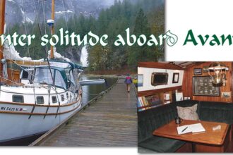
Ensconced in Pelorus’s small cabin, I tuned out the shrieking, whistling, and banging and re-read Joshua Slocum’s Sailing Alone Around the World. I like to revisit this book every year. I mostly sail solo, and not only does Slocum’s classic reveal everything anyone needs to know about singlehanding, it imparts his contagious optimism and cheerful self-reliance that I find renewed within myself with each reading. Yet, the book is also sobering. Slocum was washed up at 51 when he began his famous voyage, and when he was lost at sea at age 65, he was younger than I am.
 It was late afternoon on the second day when the weather cleared, but too late in the day for me to get underway. The following morning, I motored back out into the Atlantic. I figured I could make the 55-mile run to Delaware Bay, but there was no margin of error for missing the tide when traveling up that bay, so I made it a two-day trip, with a pleasant stop near Cape May, anchored off the athletic fields of the Coast Guard boot camp. The next morning, I made the short trip across the bay’s mouth to Lewes, Delaware, and tied up at the town dock in the Lewes and Rehoboth Canal, as I had family to visit and errands to run.

Today, Lewes is a town of middle-class homes, shops, and restaurants, but in the late 19th century, it was a fishing port, with more than 25 boats that employed over 650 people. Many of the fishermen were African American, including a relative of mine, whose last name was spelled Lewis, the same way Lewes is pronounced by locals. The primary catch was Atlantic menhaden (also known as mossbunker and bunker), a small, silver, oily-fleshed fish similar to herring. The fish were also used for fertilizer, animal food, and producing vitamin B-12. It was a nasty, smelly business that made for a hardscrabble working town. But the fishing industry was gone by the early 1960s. Today there are tourists instead.
By now, a daily routine had come into focus, beginning in the evening. After dinner, I planned the next day’s route before turning in with a book. Early the next morning, I listened to weather on the VHF before getting out of my bunk, then made coffee and breakfast and was underway at first light. Generally, I’d arrive at my destination by mid-or late afternoon, plenty of time to find a back-up spot if there was a problem. I’d anchor, and then, before dinner, inspect the engine, check the oil and fuel levels, and walk the deck, looking for anything that might be about to break. It was a comforting routine, with few surprises.
Properly timing the tide in the Delaware Bay is key for a small boat like mine to make it cleanly and quickly up this broad, open, and frequently boisterous body of water. The next morning, I caught it perfectly and rode it north 56 miles until the bay narrowed to what becomes the Delaware
River and the entrance to the Chesapeake & Delaware (C&D) Canal.
There I made the mistake of anchoring overnight in the river at Reedy Island, just below and in sight of the canal’s eastern entrance. Pelorus swung to the tide’s strong current while a crosswind and the dinghy conspired to put on a middle-of-the-night concert of maddening thumping and crunching. Next time—if there is a next time—I’ll go the extra few miles and anchor just beyond the canal entrance at Delaware City, where the cruising guides say it’s calmer.
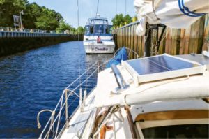
The C&D canal was my path to the Chesapeake Bay, and once I emerged from its western end into the Elk River at the top of the Chesapeake, I turned south for Mile Marker Zero of the Intracoastal Waterway, some 200 miles south in the Elizabeth River between the neighboring cities of Norfolk and Portsmouth, Virginia. Each night, I pulled into one of the beautiful and out-of-the-way anchorages the Chesapeake has in abundance. I avoided Baltimore and Annapolis and was rewarded with scenic seclusion and wildlife everywhere. It was on this stretch that I saw American bald eagles in any number, and nearly every daymark seemed to be home to pairs of ospreys who were raising their young.
I carried sail south through the Bay, using Mr. Yanmar only when the wind turned light and variable or traffic became a problem. I found the Chesapeake to have far more commercial marine traffic than my old home waters (including New York Harbor!), with ships anchored and underway. Fortunately, there’s an app for that: I relied on MarineTraffic, a free AIS app on my iPhone, to sort out traffic at chokepoints, especially near Newport News and Norfolk.
At the historic Hampton Roads of Virginia, I steered Pelorus up the short, narrow Hampton River to the Hampton Maritime Center, a short dinghy ride from the anchorage, where I found showers and laundry. Clean and refreshed, I took a lay day to visit the Virginia Air and Space Science Center, only a short walk from the maritime center. The museum was packed with historic propeller and jet aircraft, rockets, space craft, and related objects, as well as a 3D IMAX theater showing flight-related films.
Meanwhile, the weather shifted. Waiting out the nor’easter in New Jersey, I’d huddled under a blanket wearing sweats. Now, only a few days after the front blew out, the temperatures were in the 80s during the day, and I slept comfortably with the open foredeck hatch funneling a cool breeze below.
From here, there were two routes south, the main ICW, full of tugboat and barge traffic, which I wished to avoid, and the less-traveled Dismal Swamp Canal. I chose the Dismal Swamp Canal, only recently reopened after repairs from Tropical Storm Sandy (I still encountered the odd deadhead and floating tree limb). New to me were the canal locks at each end; happily, they were run by professionals.
The 22-mile Dismal Swamp Canal, connecting Virginia with North Carolina, is the oldest continually operating waterway in the U.S. and was first surveyed and planned by George Washington. At the time, the prevailing European mindset projected something fearful and frightening about unimproved land; swamps and deep forest gave them the willies. It was not surprising they chose the foreboding name they did.
Enslaved laborers dug the canal by hand from 1793 to 1805. During that time, so many successfully escaped that they formed settlements in remote, hidden parts of the area. These communities, and the individual self-freed men and women members, were called Maroons.
Life in the Great Dismal Swamp for Maroons was unpleasant and treacherous— almost entirely in swamplands—but the total population was in the thousands, and many made a living cutting timber and negotiating its sale and transportation along the canal, all the while avoiding the predation of slave catchers. In fact, while Maroons were in several parts of the U.S., the Great Dismal Swamp population is believed to have been the largest. Like others, it contributed to the success of the Underground Railroad.
Washington’s original idea was to drain the swamp (literally). When that proved untenable, the goal became to ease the transportation of goods by water. However, once the much deeper and broader Albemarle and Chesapeake Canal was completed in 1858, the Dismal Swamp Canal fell into disrepair. In 1929, the federal government purchased the canal and improved it sufficiently for small boat traffic, but not for tugboats and barges.
Compared to other stretches of the ICW, the Dismal Swamp Canal is lush and verdant, belying its name. However, because it is so narrow (as little as 25 feet wide in places), and because trees grow alongside and overhang it, there’s no safe place to anchor in it once you have passed through the locks. To overnight, you can tie up at the commodious Dismal Swamp Canal Welcome Center (and, since other boats likely will raft up with you, it’s a fun way to meet fellow travelers). Close attention must be paid to steering; at one point, while dodging a floating deadhead, I managed to scrape my masthead clean on a tree limb (my only damage of the trip). Fortunately, I carried a spare anchor light.
Although much of the Dismal Swamp Canal is rail-straight, even for a few miles past the South Mills lock at the southern end, the route becomes wildy circuitous once into the narrow upper reaches of the Pasquotank River. Wandering off-channel by even a few yards can result in grounding, as I proved a number of times.
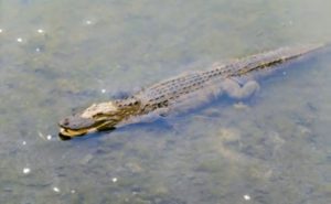
Eventually, the ICW widened, and in Elizabeth City, North Carolina, civilization appeared, then disappeared the following day as I crossed Albemarle Sound and entered the Alligator River, then the Alligator River-Pungo River Canal. Cyprus trees surrounded low-lying, featureless swampland that appeared like the consequence of some kind of dystopic catastrophe, in which nature was only now reclaiming the landscape. On either side were stunted, half-dead, vine-covered trees. Hidden on the banks among them were alligators and snakes, some of them water snakes. Seabirds were absent. I wasn’t in New Jersey anymore.

Soon enough, though, I shot out into Pungo River, near Belhaven, North Carolina. There, I began to get what Joseph Conrad called “channel fever,” that feeling old-time sailors experienced homeward bound, as they headed up the last stretch of the English Channel after a long voyage. To cope with my own canal fever, and to celebrate, rather than drop the hook and dine “Chez Pelorus,” I enjoyed a restaurant meal and a quiet night at the town dock.
By the time I reached Oriental, North Carolina, roughly 40 miles further south along the Pamlico River and then Neuse River, I was three weeks into my voyage and only a short day sail from my new slip at the marina near downtown New Bern. Pelorus and I had come 634 miles.
There was little about this trip that was different from my previous summer cruises out of Raritan Bay—making progress by day, sleeping at anchor each night—but this one was longer, and the route unfamiliar. And now I’m home again, in new sailing grounds, with a boat I know like the back of my hand. I can’t wait to go sailing.
Good Old Boat Contributing Editor Cliff Moore’s first boat was a Kool Cigarettes foam dinghy with no rudder or sail. Many years and many boats later, he’s sailing Pelorus, a 26-foot AMF Paceship 26 he acquired and rebuilt after Hurricane Bob trashed it in 1991.
Thank you to Sailrite Enterprises, Inc., for providing free access to back issues of Good Old Boat through intellectual property rights. Sailrite.com