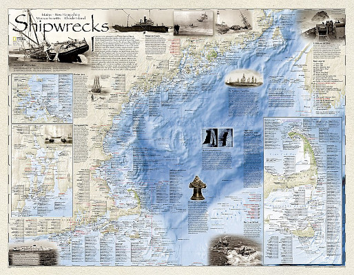
 We recently received a large (28 x 36-inch) wall map featuring the shipwrecks off the coast of Maine, New Hampshire, Massachusetts, and Rhode Island. Suffice it to say that over the years there have been a great many of them! Just off the coasts of these four New England states, the wrecks shown on the map number in the thousands. The big-picture perspective is frankly more than a little overwhelming.
The map displays ocean depths and coastal details and includes inset maps for the busier areas — where there have been many more wrecks — such as Nantucket Sound, Cape Cod Bay, Martha’s Vineyard, Narragansett Bay, and Boston Harbor Islands. Each wreck site is symbolized to define the class and type of vessel. The vessel’s name is given, along with the date of sinking.
Historical events from the mid-1600s to the 20th-century are noted. A note about the first fully authenticated pirate ship, Whydah, is highlighted in the pirates of New England section. The wreck of the Andrea Doria, in July 1956, is explained in some detail. This tragedy has been mentioned in Good Old Boat several times over the past few years.
While it’s not comfortable to spend a lot of time reading a wall map covered with small type, it makes fascinating reading, particularly if you’re from the area or familiar with some of the events that sent these ships to the bottom. As a sailor, however, I’m not sure I want this sort of reminder hanging on my wall. I’d prefer to be enthralled by the detail captured here and then to store the evidence somewhere out of sight.
A similar map of the Delmarva Peninsula has also been published by National Geographic and is available in basic paper or laminated formats. These maps are available from <www.NationalGeographic.com>. Search for “shipwreck maps.”
Shipwrecks of the Northeast, A Wall Map by National Geographic