Circumnavigating Vancouver Island provides stiff sailing, natural wonders, and kind locals.
Issue 135: Nov/Dec 2020
Years ago, after decades of sailing the Salish Sea, my wife, Carey, and I decided we were ready to venture beyond the familiar, protected waters of the Canadian Gulf Islands and Desolation Sound. For serious Pacific Northwest sailors, circumnavigating 300-mile-long Vancouver Island is the Holy Grail.

The challenges of this 700-nautical-mile voyage include remoteness, coastlines hidden in fog, unabated ocean swells, 12-knot currents through narrow channels, 14-foot tidal swings and the currents that result, and dangerous headlands along the untamed Pacific coast. Beyond the open-ocean sailing challenges, the circumnavigation was an opportunity to reach remote places we’d heard and read about.
Planning for our adventure started with charts and cruising guides. A few things became immediately clear. First, venturing to the west side of Vancouver Island was best done early in the summertime, before the fog of late July and August enveloped the coast. (Residents of the remote villages along the coast refer to Fogust for a reason!)
We learned that the preferred direction for a circumnavigation would be counterclockwise, up the inside of Vancouver Island and down the outside, taking advantage of the prevailing summer northwest winds along the outer coast. Finally, we learned that to complete the voyage, we’d have to overcome six challenges we’d face along the way: Johnstone Strait, Nahwitti Bar, two notorious capes (Scott and Cook), Estevan Point, and Juan de Fuca Strait on the home stretch. I felt equal shares of trepidation and excitement.
We allowed seven weeks for the voyage, realizing that would put Dreamer, our 1978 Islander Bahama 30, on a pace that was fast but still permit some time to explore. Because that was more time than Carey could take off work and because our daughter, Nicky, was still in school, I found willing friends to crew early legs of the trip.
By late May, the boat and her crew were as ready as we could be.
My friend Jim, a sailing novice aboard as crew for the first leg, and I departed Tsawwassen, part of metropolitan Vancouver, and sailed north up Georgia Strait. After successfully timing fearsome tidal rapids just north of Desolation Sound, I felt anxious as we approached the first great challenge of this voyage, Johnstone Strait.
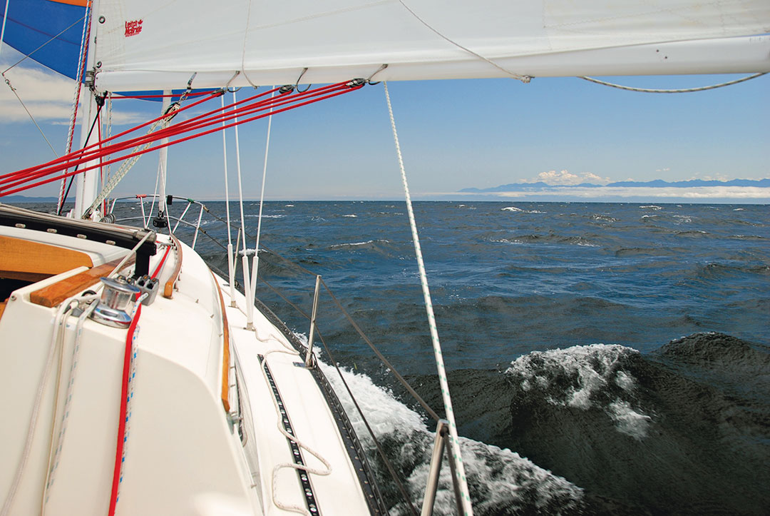
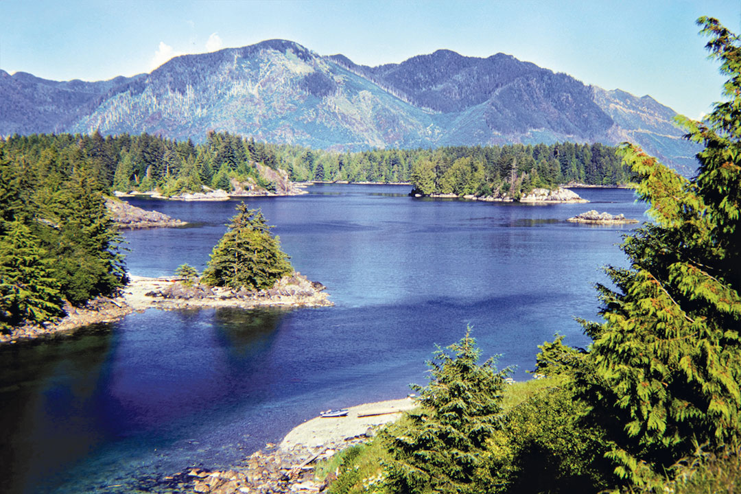
A deep, narrow, 40-mile-long, glacier-carved passage notorious for strong currents and westerly winds, Johnstone Strait is also heavily used by freighters and cruise ships. Common are days of sustained 30-knot headwinds that blow against ebbing tides to create short, steep seas that make passage all but impossible for small boats. Once in, there are few places to stop and wait for weather. Turning around is often the only option should conditions deteriorate or if the tidal currents are poorly timed.
We rounded Chatham Point into Johnstone Strait against a light westerly, tacking to windward in near perfect conditions. What a start! But by mid-afternoon and with 27 miles to go, we were down to just the 90 percent jib and crashing through waves under low, threatening clouds, looking for refuge. Fortunately, Port Neville was just off to starboard and we dove in for shelter.

The next day broke with low, scuttling clouds announcing the arrival of a low-pressure system with southeast winds. Although the scenery was less than inviting in the showers, a six-hour spinnaker run was an unexpected reprieve from what could have been a very difficult windward passage.
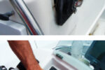
With our first major hurdle behind us, we enjoyed the easy sail to Port Hardy, the northernmost community on Vancouver Island. Port Hardy was where I said goodbye to Jim and welcomed Paul aboard for the second leg; it was also the site of an equipment malfunction. Without warning, the VHF radio was failing intermittently.
After determining the radio was the fault, I approached a local chandlery about the likelihood of getting it repaired. The chandlery owner threw Paul and me the keys to his truck and directed us up the highway to a “guy who does repairs.” The next morning, our working radio was delivered to the boat—small communities at their best.
Nahwitti Bar, a shallow stretch of water between Hope Island and the northernmost tip of Vancouver Island, was the next hurdle. Fortunately, Paul is an avid sailor with ocean sailing experience, which added to my level of confidence. We departed Port Hardy in showery, unsettled weather for the 24-mile run up Goletas Channel under spinnaker.
Because conditions have to be just so to transit the waters ahead, we pulled into Bull Harbour on Hope Island to wait for a safe window to cross the bar. I was wary of ocean swells that, combined with an ebbing tide against a westerly wind, can pile up against the rapidly rising seabed to create monstrous seas that have caused many substantial ships to founder. We watched the weather and studied the published tide tables, as even in benign conditions, a contrary tide would bring our 5-knot vessel to a standstill.

It was the next morning when the stars aligned for us and we were underway. Again with the spinnaker flying, we sat back while it pulled us north over the bar in nearly flat seas and sunshine. But just as we began to celebrate, heavy, dark clouds rolled in from the south as we plowed past Cape Scott in 6- to 8-foot swells on a now-windless sea. I lost my breakfast while trying to capture the raw beauty of the crashing surf and rugged shore with my camera. But no matter, we’d cleared the second and third hurdles of the circumnavigation!
In some of the remote anchorages on the northern outside coast of Vancouver Island, the adventures ashore proved equal to those at sea. Deep fjords pierce the coast, offering few safe havens for boats of any size. At Sea Otter Cove and, further south, Klaskino anchorage, there wasn’t another boat in sight. Black bears wandered the beaches and sea otters dotted the clear waters.
We bushwacked swampy, primitive trails that led to spectacular sandy beaches on the exposed coast. I carried bear spray as a defensive measure; this was still springtime, and our chance of encountering mothers and cubs was real. Finding plenty of fresh bear scat was not reassuring, so we purposefully made lots of noise.
Back at sea, our next challenge was rounding Cape Cook, aptly named Cape of Storms. It marked the tip of the Brooks Peninsula, a mountainous thumb that protrudes 12 miles into the Pacific. Winds that blow down the coast funnel around this imposing land mass, dramatically increasing in velocity at the cape. The guidebook advised that winter winds there could blow 90-plus knots.

We departed Klaskino anchorage without VHF reception and therefore no forecast. Outside, conditions looked ideal, a westerly wind that would allow us to sail on a close reach to the cape, then a broad reach past the headland, followed by a broad reach into the lee of the peninsula.
With a degree of excited apprehension, and with the anchor secured at the bow and the dinghy deflated and stored below, we soon were sailing in a steady 20 knots that blew from the northwest. Sweeping, whitecapped seas rolled by us like moving snow-capped mountains as we hurtled along the lee shore on a tight reach with a reefed main and 90 percent jib. The boom nearly dragged in the waves and spray flew back to the cockpit.
With that lee shore looming to port, and no guarantee the mast would stay up in these conditions, I jokingly (but seriously!) reminded Paul that a sea anchor was stowed under the quarter berth. Help would be a long time coming if the rigging failed. We briefly considered turning back, but the tip of the peninsula was only two hours away, and the exhilarating sailing was like nothing I’d experienced. Besides, we still had the option of dousing the reefed main and sailing under the jib alone. The closer we got, the more the wind and waves continued to build. Our focus was complete, navigating one mountainous wave at a time.
By the time we rounded the tip of the peninsula, we’d fought down the main and were surfing in 40 knots of wind. Juxtaposing our wild ride were brilliant blue skies and the deepest blue water. When we finally jibed into the lee of the peninsula, we were equally relieved and disappointed that the terrific sail was over. We reached for the tranquil waters of Columbia Cove, an anchorage nestled in an isolated crook. When we arrived, we relaxed in calm waters and warm sunshine, still buzzing with adrenaline.

We stayed put for a few days, exploring the rock-spired beaches of the Brooks Peninsula Ecological Reserve under sunny skies and warm winds. Columbia Cove features the added surprise of a wrecked Canadian Coast Guard cutter. The entire ship was still there, the armored glass of the wheelhouse missing and the forecastle full of water. We learned later that an entrepreneur had purchased the decommissioned vessel and was having it towed north along the coast when it broke loose in a storm, ending up here. We climbed aboard and tried (and failed) to get through corroded hatches. The expansive teak decks were enticing until we realized we had no way of removing or transporting that much lumber.
A short sail away, we discovered Big Bunsby Marine Provincial Park, popular with adventure kayakers who relish the uniquely protected waters on this wild coastline. Paul and I meandered for the next couple of days, exploring this beautiful place.
We could have spent more time in the islands, but Paul’s time was up. Ten miles south of the Bunsby Islands, we tied up to the community wharf of the remote village of Kyuquot, on Walter’s Island. A First Nations village accessible only by air or boat, Kyuquot is home to a fish processing plant and a small general store. There is no road on the island, and homes are connected by foot paths and docks, the primary method of travel being small boats. Likewise, with no phone service, residents communicate with each other via VHF.
Despite a flight connection failure, Paul managed to score a ride out on the scheduled Nootka Air mail plane. I learned that his replacement crew was not coming; suddenly, I was a singlehander.
Fortunately, there were only 42 miles and a full week between me and the inland village of Tahsis, my rendezvous point with Carey and Nicky. My week as a singlehanded sailor was lonely, still not another boat in sight for days. The sunny weather came and went, along with the rains.
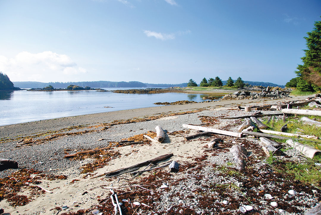
My first stop was Rugged Point Marine Provincial Park. A somewhat exposed anchorage just inside the coast, the park has miles of sandy beaches facing the Pacific. I found an old logger’s cabin on the well-marked but rough forest trail leading to the beaches, complete with dry firewood and stove, emergency food and water, and a note asking for respectful use of the survival supplies. The beach payoff at the end of each hike was spectacular, white sand shared only with seagulls and sandpipers.
Along the shore sailing south, I found large sea caves as a backdrop to open-roadstead anchorages. I rowed ashore to get up close and personal with two of the larger caves, only to discover animal tracks in the sand that disappeared into the darkness, one way. This stopped me cold, and I backed out to enjoy the relative safety of the open beach and the dinghy. I was acutely aware of being completely alone, miles from any help, and perhaps out of range of VHF radio.
Fortunately, the winds stayed relatively light as I made my way into Esperanza Inlet and eventually Tahsis.
Tahsis was a welcome sight after days of talking to myself. I tied up to a small public wharf apart from the forestry village. Tahsis is set miles up a mountainous fjord, so I was surprised to find the dock exposed to the afternoon westerlies that set Dreamer rocking. I needed propane and, with the 20-pound tank in hand, headed up the road towards town. The first vehicle coming up behind me stopped, the young woman behind the wheel offering me a ride to the only gas station.

While staff filled the tank, I fell into conversation with the local RCMP officer assigned to Tahsis on a two-year post. As happens when traveling, I was reminded how small the world is when I learned he was stationed here from Vancouver and knew some of the city police officers with whom I worked. He offered to drive me back to the boat and pointed out the modern community center at the heart of the tidy little town. Nothing beats a full-sized pool and showers for a lone sailor a long way from home!
Carey and Nicky arrived on a rainy day with our two cats, Bozo and Nifty. Happy to see them, I took stock of the trip so far and looked forward to what was to come.
Bert Vermeer and his wife, Carey, live in a sailor’s paradise. They have been sailing the coast of British Columbia for more than 30 years. Natasha is their fourth boat (following a Balboa 20, an O’Day 25, and the Islander Bahama 30 Dreamer. Bert tends to rebuild his boats from the keel up. A retired police officer, he also maintains and repairs boats for several non-resident owners.
Thank you to Sailrite Enterprises, Inc., for providing free access to back issues of Good Old Boat through intellectual property rights. Sailrite.com