Grimsby to Georgian Bay, and why you should never bring bananas on board
Issue 153: Nov/Dec 2023
In the cold days of January 2023, my wife and I made the move from Hamilton to Barrie, Ontario. There was a dilemma, though. Moving our belongings over land was one thing, but what about our sailboat?
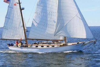
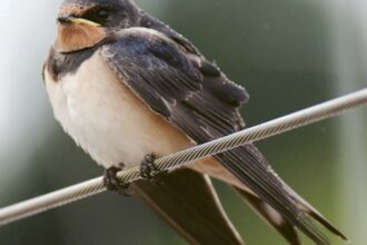
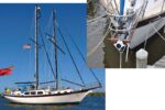
Ten years prior, I had jumped into the deep end of sailing with both feet. We kept our Mirage 29, SeaLah, at Fifty Point Marina near Grimsby, Ontario, on the southwestern shore of Lake Ontario. Now it was time to move the boat and I was faced with three choices: Have SeaLah trucked to our new home port, put the mast down and transit the TrentSevern Waterway, or choose the outside passage through the Welland Canal, Lake Erie, Detroit River, Lake St. Clair, St. Clair River, Lake Huron, and into Georgian Bay. For an avid adventurer and sailor, there was only one option — we were doing the “Great Lakes Shuffle.”
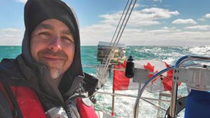
On Sunday, May 14 — Mother’s Day — we arrived at Fifty Point Marina to onboard two crew, Ron Ouwehand and Peter Layard, and shove off for the voyage west. We exited Fifty Point channel and waved goodbye to my wife, who would pick me up at the journey’s end.
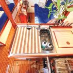
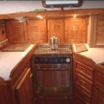
We got off to an inauspicious start. There was no wind, which meant a nearly fourhour motor to Port Weller and the Lake Ontario entrance to the Welland Canal. Since it was May, there were lots of pesky but harmless midges. The weather was cool but beautiful, and supper beckoned. When the barbeque failed to light, Peter took the grill apart and found a spider’s nest blocking the propane flow at the entrance to the burner tube. At the same time, we discovered that the Raymarine speedometer wasn’t showing a reading. I found the paddlewheel and rewired it.
What could possibly happen next? Yet another disaster reared its ugly head as we motored. My iPad, with Navionics loaded and maps downloaded, did not track our movement through the water. After an hour of frustrating research, I realized my iPad was not equipped with native GPS. You’ve got to be kidding me! Three challenges at the outset of our voyage.
Then for dessert, I pulled out some bananas, to which Ron asked incredulously, “You brought bananas? Never eat bananas on a boat!” I had no idea there was a maritime superstition about this potassium-laden fruit. I scoffed at Ron’s fear and we all ate a banana.
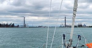
 Farewell, Lake Ontario
We arrived at the Welland Canal and tied off at the Seaway Welland wharf to wait for our transit the next morning. Thankfully, my wife was still in Hamilton that night and came back with a second iPad, which, it turned out, also did not have GPS. So at 9:30 p.m., we drove to Walmart and bought a Samsung tablet with GPS. I was elated to see that after Navionics was installed, this new tablet showed our position and heading on the map.
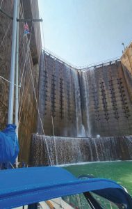
The next morning, we cleared the decks of bug guts and bird poop and entered Lock 1 at 9 a.m. We went through solo and had a fairly uneventful 8.5hour transit. A crew of three is needed traveling upbound because of the work required fending off the rough cement walls. A lot of water boils in from below, tossing pleasure craft about like toy boats. Two long lines were lowered from the top of each lock, allowing us to guide our bow and stern. I brought along a 2 x 8 board that we tied outside the fenders. The plank took signifi cant abuse caused by scraping up the lock walls, thereby helping to protect the fenders and SeaLah’s hull. Peter said goodbye once we reached Port Colborne, which is the entrance to Lake Erie — our second Great Lake of the voyage. As dusk descended, Ron and I watched the fi lm Master and Commander, a mustsee for sailors. How very fi tting to watch this masterful tale while listening to the creaking of my own boat.
The Lake Erie Hop
After a bout of crazy, unfavorable southwest wind in the 20to 25knot range, we awoke in the darkness on May 17 and left the dock just before 4 a.m. It can be challenging to exit an unknown port in the dark, even with Navionics, and we were unsure why the Port Colborne pier lighthouses showed green right returning, opposite colors to normal. Must be something to do with the Welland Canal, we thought. It was cold and the wind was from the north at a steady 20 knots, gusting to 25 with waves at 3 to 6 feet. We set the autopilot on a westsouthwest heading for Long Point and motored at an easy 2,400 rpm, with full jib and no main, averaging 6.5 knots of speed and topping out at 9.1 knots.
But then, wham! For the second time since installing a Raymarine wheel pilot six years earlier, the belt broke. In a big fl ourish of waves and swell, the autopilot lost its heading and could not keep the boat straight. We tried again a couple of times, to no avail, and resorted to hand steering. Ron wryly commented on my “banana belt” and I wondered if there might be something to the banana superstition. I immediately purchased two new replacement belts from a marine store and arranged for delivery through Peter, who would soon rejoin us. After a 15-hour sail, we motored into Port Stanley at 7 p.m. to find a quaint town on the west shoulder of Long Point.
We left early the following day, catching the first exit bridge possible out of Kettle Creek. We had an easy motorsail 8 miles offshore with an easterly wind of 10 knots, being careful not to get fouled in several strings of commercial fishing nets with flags indicating buoys connected to leaders going deep under the surface. It was another long day of sailing and we had just enough light to get into Scudder Marina on the northern shore of Pelee Island.
From Pelee Island we headed for Leamington, with sunny and warm weather that finally allowed us to shed layers. It was a quick hop with 10 knots behind and it was time for a crew change. Peter met us, allowing Ron to return home for work, and we shoved off for the twohour motorsail west to Colchester, Ontario. Colchester is a small community on Littles Point, where the marina is staffed by teenagers, rules are suggestions, and red tape is nowhere to be found. Lovely.
The Gordie Howe International Bridge,
linking Windsor, Ontario, and Detroit, Michigan. This massive bridge will boast the longest single span in a suspension bridge in North America.
Channel Surfing
Before leaving, I thought about the banana superstition again as I repaired the autopilot, hoping it would work for the remainder of our journey. We entered the Detroit River at 10 a.m. and traversed the Amherstburg Channel, where the river current varied between 1 and 2 knots against us. Our speed over ground depended on whether we sailed the midchannel or along one of the shores. Choosing to primarily hug the Canadian side, we passed Boblo Island and Ballards Reef, then snaked in behind Turkey Island. We saw dozens of swans, but no turkeys. From there we followed the long, skinny channel to the east of Fighting Island and in the distance saw the massive twin towers of the future Gordie Howe International Bridge, which will have the longest main span of any cablestayed bridge in North America at almost 3,000 feet.
Soon after, we passed the Ambassador Bridge and Belle Isle and approached Lake St. Clair. Peter and I were engrossed in good conversation in the cockpit when I glanced behind and saw a fullsized freighter bearing down on us. We veered to port in a hurry. Another lesson learned: Never lollygag in a shipping channel.

Once on Lake St. Clair, we had a beautiful sail on a reach with just the jib in 14 knots of wind, making 5 knots of boat speed. We anchored in a manmade gunk hole in Huron Point, Michigan, by the Lake St. Clair Metropark Marina. That’s when another banana problem befell the good ship SeaLah. My newly installed, brand new LED anchor light failed to work. It tripped the breaker — evidence of a short somewhere. Grrr!
We had no luck fixing the anchor light, as it seemed the wires were pinched at the base of the mast. Since all the connections were buried within the tabernacle, I would need to loosen the rigging and have the mast lifted to fix the problem. Banana bummer.
I pulled the anchor up at 8 the next morning and we meandered out of the channel, through Lake St. Clair to its middle channel past Harsens and Walpole islands and then entered the St. Clair River proper. We arrived at Sarnia’s Bridgeview Marina at 5:30 p.m. and met an old friend who drove us to refi ll the propane tank, do my laundry, and get fries at the pier under the Blue Water Bridge. It was an iconic location with great food.
Onward to Lake Huron
On May 22, Peter was called home and could not continue the journey, so he left for the train and I was off by 8 a.m. singlehanded As I reached my third and fi nal Great Lake, Huron, I carefully passed several commercial fi shing nets and entered the lake’s wide open southern basin. The conditions were exceptionally calm and my Yanmar faithfully purred along all day, pushing SeaLah at around 5.7 knots. The sky was foggy, and for much of the afternoon I could see no shoreline whatsoever. As I approached Goderich — the town where I was born — the skies fi nally cleared and I saw the unmistakable teal color of the Goderich Salt Mine buildings. Located 1,800 feet under Lake Huron, the mine is the largest underground salt mine in the world.
I found a slip at Maitland Valley Marina just after 6 p.m. and since it was still early, I unstrapped the kayak and paddled up the Maitland River and under an old railway bridge. The fi sh were impressive — from millions of minnows to fi sh 3.5 feet long!

Worry woke me at 4 a.m., as I wondered where I should go and how far I should travel that day. A favorable southwesterly breeze was in the forecast, but the following day was expected to bring atrocious northeast winds. Wanting to use the wind I had, I slipped the dock lines at 5:30 a.m. and enjoyed another cold morning watching the sun rise.
While I sailed north, the day warmed and I spent a good hour in the sun scrubbing the deck. In the afternoon, with still no wind to speak of, thick fog rolled in from the northwest. I could only see 50 yards in front of the bow and had to keep a sharp lookout. After another 15hour day, I pulled into Stokes Bay and tied up to a decrepit government wharf. It was strong and, I hoped, suffi cient for the big blow to come.
The weather forecast did not disappoint. At around 5 a.m., the northeasterly front hit with winds up to 30 knots and lasted for several hours. I went outside in the predawn light and added more dock lines for security. I had never used seven lines to secure my boat before, and SeaLah was getting splashed by waves hitting the other side of the pier 20 feet away. The rest of the day remained windy and bitter, but beautifully sunny.
The Homestretch
At this point I was only two days away from my fi nal destination. A 10knot northeasterly wind pushed me out of Stokes Bay, past Lyal Island to port and Mad Reef to starboard. To keep myself closer to shore, I carefully threaded my way inside Greenough Bank. It was eerie to see the bottom detail only 20 feet down as if it were 5 feet. I was not used to this kind of clear water in Hamilton.

In midmorning I turned off the motor, put up all the canvas I had, and sailed along at 6 glorious knots. It was calm, controlled, and smooth. Eventually, the wind direction forced me too far off shore and I put the sails away and turned on the motor. At noon I rounded “the horn,” Cape Hurd, and entered Cape Hurd Channel. While the northwest shore of the Bruce Peninsula was largely devoid of anything manmade, the north shore was loosely dotted with mansions on the water, with views to die for.
I skirted clockwise around Flowerpot Island and saw its stately stone monuments resembling flowerpots, then motored in calm seas to the tip of the peninsula. On the way, two things struck me: First, the channel here is over 550 feet deep! This is by far the deepest water SeaLah has sailed in. Second, beyond the harbor village of Tobermory, the entire northern peninsula shore is rugged, natural landscape devoid of human interference, and is stunningly beautiful.

I pulled into the Wingfield Basin on Cabot Head. This small lake is completely surrounded by land and is recommended by boaters as a great hurricane hole. Although this oversized pond could easily accommodate 20 boats on the hook, I was the sole boater. While the sun was up, I kayaked the circumference and got out to walk marvelous trails to the Cabot Head Lighthouse.
After nearly two weeks traversing through Lake Ontario, the Welland Canal, Lake Erie, the Detroit River, Lake St. Clair, the St. Clair River, Lake Huron, and Georgian Bay, it was my last day on the water. I retrieved my Rocna from 10 feet of crystal clear, azure water and exited the basin. It was a cool, bright, calm morning and I watched a stunning sunrise over Georgian Bay as I began a straight shot of 56 miles on one heading. I was more than glad for Navionics on this trip. Georgian Bay is littered with islands and I could not imagine fi nding my way solely with paper charts.
I experienced one final, aggravating mishap. As I approached my destination, a passing boat put up a big wake that made SeaLah roll. This motion caused my loose companionway doors to fall into the cabin, badly gouging the cabin sole. Was it another banana bungle that confirmed the old superstition? Nah. Bananas or not, things always break when you’re sailing, but that won’t keep me shackled to the dock. If you are blessed to live near the Great Lakes, endless cruising grounds await. Go and explore.
Lee Brubacher and his wife, Cheryl, sail their Mirage 29, SeaLah, out of Queen’s Cove Marina in Victoria Harbour at the southern end of Georgian Bay. When not on the water, Lee can be found on stage as the pastor of worship and creative arts at Emmanuel Church in Barrie, Ontario.
Thank you to Sailrite Enterprises, Inc., for providing free access to back issues of Good Old Boat through intellectual property rights. Sailrite.com